Disclosure : This site contains affiliate links to products. We may receive a commission for purchases made through these links.
The Kimberley – Gibb River Road Hema

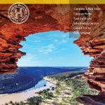
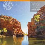
The Kimberley, the northernmost part of Western Australia, on a waterproof and tear-resistant map from Hema with highlighting for the Savannah Way, an index showing locations with their GPS coordinates, plus on the reverse enlargements for the Gibb River Road, Dampier Peninsula, Purnululu National Park, and the Ngamoowalen Conservarion Park area.On one side is a map at 1:1,000,000 of the Kimberley area of Western Australia, extending south to approx. 19ยฐ45’ and east just beyond the border with Northern Territory. Topography is well presented by relief shading and graphics for swamps, salt flats, deserts, etc, plus plenty of names of mountain ranges, peaks, etc. National parks and other protected areas are prominently highlighted and the map also shows the boundaries of various types of Aboriginal Lands and restricted entry zones. Presentation of roads and tracks indicates sealed or unsealed roads, tracks are graded according to difficulty, and the map highlights the course of the Savannah Way from the NT/WA border to Broome plus its continuation southwards along the Great Northern Highway. A wide range of symbols indicate various services and facilities including fuel and drinking water supplies, camping and other overnight accommodation, vehicle repairs, etc. For many locations the map also provides a phone number for the main tourist facility (accommodation, visitors’ centre, a store, etc). Many locations are annotated with brief notes. The map has latitude and longitude lines at 30’ intervals plus and index listing locations with their GPS coordinates.On the reverse, the alternative route from Derby to Kununurra along the Gibb River Road is shown in more detail at 1:900,000 with 29 locations cross-referenced to their descriptions. Three more panels show the Dampier Peninsula (1:350,000), Purnululu NP (1:200,000), plus the Ngamoowalen Conservation Park and the surrounding area between Kununurra and Wyndham (1:300,000). The title also includes a table of facilities in the region’s national parks, a list of useful contact details, plus general notes about the whole region.To see other titles in Hema’s series of detailed regional road maps of Australia please click on the series.


