Disclosure : This site contains affiliate links to products. We may receive a commission for purchases made through these links.
The High Fells of Lakeland

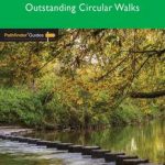
Are you planning a holiday to the Lake District? Do you enjoy a hill-walking challenge with impressive mountain-top views? Inside Pathfinder (R) Guide to the High Fells of Lakeland are 20 majestic and challenging fell walks amid the glorious scenery of the Lake District mountains with clear and easy-to-follow route directions compiled from the author`s 40 years` experience of Lakeland walking. For adventurous ramblers and walkers wanting a hill-walking challenge, this brand new Pathfinder (R) walking guide features 20 demanding day-walks in the mountains of the Lake District, from Scafell Pike (highest mountain in the Lake District), to Helvellyn, Skiddaw, Great End and Bowfell – all over 900m (nearly 3000 feet) high. Giving a detailed guide to 20 inspiring expeditions on the high fells of Lakeland, Pathfinder (R) Guide to the High Fells of Lakeland explores some of the best fell walking country in the Lake District. With views over to Buttermere, Derwentwater and Grasmere, the Lakeland Fells offer some of the most superb experiences of the Lake District for the adventurous walker and Pathfinder (R) Guide to the High Fells of Lakeland allows ramblers to easily enjoy these mountain views with clear, large-scale Ordnance Survey route maps and GPS waypoints to help you navigate your walk with ease. If you`re a walker who really wants to make the most of what Wainwright described as the `splendid walking country` of the Lake District, make sure you don`t set off on your fell walk without a copy of Pathfinder (R) Guide to the High Fells of Lakeland in your rucksack. Pathfinder (R) Guides are Britain`s best loved walking guides. Made with durable covers, they are the perfect companion for countryside walks throughout Britain. Each title features circular walks with easy-to-follow route descriptions, tried and tested by seasoned walkers and accompanied by beautiful photography and clear, large-scale Ordnance Survey mapping.


