Disclosure : This site contains affiliate links to products. We may receive a commission for purchases made through these links.
Categories
-
Best Sellers
-

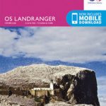
Duns, Dunbar & Eyemouth OS Landranger Map 67 (paper)
Paper version of map No. 67 from the Ordnance Survey’s Landranger series at 1:50,000, with contoured and GPS compatible topographic mapping plus tourist information.MOBILE DOWNLOADS: As Read More » -

World Monuments: 50 Irreplaceable Sites to Discover, Explore, and Champion
A stunning tour of 50 of the world`s most extraordinary destinations selected from the World Monuments Fund`s most important sites of global heritage. In commemoration of Read More » -

Cologne City Pocket Plan
About these maps:Street maps covering a slightly smaller area than that represented on the Falk Extra edition, thus folding down to a more handy size (10 Read More » -

Tony and Susan
Fifteen years ago, Susan Morrow left her first husband Edward Sheffield. One day, comfortable in her home, and her second marriage, she receives, entirely out of Read More » -

Inglorious Empire: What the British Did to India
The Sunday Times Top 10 bestseller on India`s experience of British colonialism, by the internationally-acclaimed author and diplomat Shashi Tharoor`Tharoor`s impassioned polemic slices straight to the Read More » -

Outline: A Novel
Outline is a novel in ten conversations. Spare and lucid, it follows a novelist teaching a course in creative writing over an oppressively hot summer in Read More » -

East Hamburg
East Hamburg on a topographic map at 1:200,000 from the Bundesamt fรผr Kartographie und Geodรคsie, Germany’s federal mapping agency. The map covers an area of approximately Read More » -

Stanley and the Magic Lamp
The magical and brilliantly funny adventures of everyone`s favourite flat boy – Flat Stanley. With wonderful new illustrations by the award-winning author/illustrator Rob Biddulph. Magical things Read More » -

Canada NGS Executive Wall Map PAPER
Canada on the NGS Executive style wall map, size: 97 x 81cm (38″ x 32″ approx) – paper version, showing the country at 1:6,400,000 in an Read More » -

Fredriksberg
Topographic survey of Sweden at 1:50,000, the Terrรคngkartan, from the Lantmรคteriet, covering most of the country in 244 double-sided maps. Please note: the mountainous regions of Read More »
-


