Disclosure : This site contains affiliate links to products. We may receive a commission for purchases made through these links.
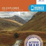
The English Lakes – South-Western Area – Coniston, Ulverston & Barrow-in-Furness OS Explorer OL6 ACTIVE

OS Explorer is the Ordnance Survey`s most detailed map and is recommended for anyone enjoying outdoor activities such as walking, horse riding and off-road cycling. The series provides complete GB coverage and can now be used in all weathers thanks to OS Explorer – Active, a tough, versatile version of OS Explorer. The OS Explorer Active range of OL maps includes a digital version of the paper map, accessed through the OS smartphone app, OS Maps.

Related Products:
 The English Lakes – South-Western Area – Coniston, Ulverston & Barrow-in-Furness OS Explorer OL6
 English Lakes South Western – Coniston, Ulverston & Barrow-in-Furness OS Explorer Map OL6 (paper)
 The English Lakes – North-Western Area – Keswick, Cockermouth & Wigton OS Explorer OL4 ACTIVE
 The English Lakes – South-Eastern Area – Windermere, Kendal & Silverdale OS Explorer OL7 ACTIVE
 The English Lakes – North-Eastern Area – Penrith, Patterdale & Caldbeck OS Explorer OL5 ACTIVE
 Dartmoor OS Explorer OL28 ACTIVE
 Isle of Arran OS Explorer 361 ACTIVE
 Wye Valley & Forest of Dean OS Explorer OL14 ACTIVE
 North Pembrokeshire / Gogledd Sir Benfro OS Explorer OL35 ACTIVE
 Brighton & Hove – Lewes & Burgess Hill OS Explorer OL11 ACTIVE
 Holy Island & Bamburgh – Wooler – Belford & Seahouses OS Explorer 340 ACTIVE
 Yorkshire Dales – Northern & Central Areas – Wensleydale & Swaledale OS Explorer OL30 ACTIVE
 New Forest – Southampton – Ringwood – Ferndown – Lymington – Christchurch & Bournemouth OS Explorer OL22 ACTIVE
 Howgill Fells & Upper Eden Valley ACTIVE
 The English Lakes – North-Western Area – Keswick, Cockermouth & Wigton OS Explorer OL4
 The English Lakes – South-Eastern Area – Windermere, Kendal & Silverdale OS Explorer OL7
 The Peak District – White Peak Area – Buxton – Bakewell – Matlock & Dove Dale OS Expolorer OL24 ACTIVE
 The English Lakes – North-Eastern Area – Penrith, Patterdale & Caldbeck OS Explorer OL5
 Isle of Wight OS Explorer OL29 ACTIVE
 Land`s End – Penzance & St Ives OS Explorer 102 ACTIVE
 Cadair Idris & Llyn Tegid OS Explorer Map OL23 ACTIVE
 Barrow-in-Furness & South Lakeland OS Landranger Active Map 96 (waterproof)
 Harlech, Porthmadog & Bala / Y Bala OS Explorer OL18 ACTIVE
 Peak District Dark Peak OS Explorer OL1 ACTIVE
 The Broads – Wroxham, Beccles, Lowestoft & Great Yarmouth OS Explorer OL40 ACTIVE
 Snowdon / Yr Wyddfa – Conwy Valley / Dyffryn Conwy OS Explorer OL17 ACTIVE
 The Long Mynd & Wenlock Edge – Church Stretton & Craven Arms OS Explorer 217 ACTIVE
 Hadrian`s Wall – Haltwhistle & Hexham OS Explorer OL43 ACTIVE
 Newmarket & Haverhill – Barrow, Clare & Kedington OS Explorer Active Map 210 (waterproof)
 The National Forest ACTIVE
 Torbay & South Dartmoor – Totnes & Salcombe OS Landranger 202 ACTIVE
 Yorkshire Dales Southern & Western – Whernside, Ingleborough & Pen-y-ghent OS Explorer OL2 ACTIVE
 Brecon Beacons Western & Central OS Explorer Active Map OL12 (waterproof)
 Dartmoor OS Explorer OL28
 North York Moors Western OS Explorer Active Map OL26 (waterproof)
 Kintyre South – Campbeltown OS Explorer Active Map 356 (waterproof)
 Teviotdale South – Hawick OS Explorer Active Map 331 (waterproof)
 Barrow-in-Furness & South Lakeland OS Landranger Map 96 (paper)
 South Harris – Taransay OS Explorer Active Map 455 (waterproof)
 South Pembrokeshire OS Explorer Active Map OL36 (waterproof)