Disclosure : This site contains affiliate links to products. We may receive a commission for purchases made through these links.
The Earth at Night NGS Wall Map

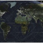
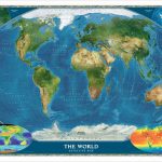
The Earth at Night wall map from the National Geographic Society, 94 x 56cm /(37″ x 24″ approx) a thought provoking satellite image with far more information that meets the eye at the first glance. The map was produced as a composite of satellite images from cloud-free nights gathered over a one-year period.White colour highlights greater population density, indicating not only urban conurbations but also uneven distribution of population in many areas; the Nile and its delta, along the Trans-Siberian railway, the contrast between Sumatra and Java, etc.Orange shows areas of slash-and burn agriculture, red marks wasteful burn-offs of natural gas, while bright blue colour indicates night fishing. Brief notes provide comments and tips for interpreting various features on the image.The map can be an excellent educational tool for discussing the contrast between the developed countries and the Third World, a puzzle naming various cities, etc.

Related Products:
 Bright in the Night
 National Geographic Earth at Night
 In the Night Garden: 123
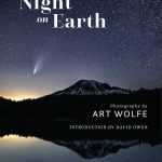 Night on Earth: Photographs by Art Wolfe
 The World at Night: Spectacular Photographs of the Night Sky
 Night Haunts: A Journey Through the London Night
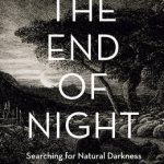 The End of Night: Searching for Natural Darkness in an Age of Artificial Light
 WOW! It`s Night-time
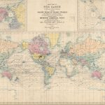 Stanford`s Route Map of the Earth Colour (1854) – A1 Wall Map, Paper – Print on Demand
 World Satellite Image NGS Wall Map PAPER
Stanford`s Route Map of the Earth Colour (1854) – A3 Wall Map, Paper
Stanford`s Route Map of the Earth Colour (1854) – A3 Wall Map, Canvas
Stanford`s Route Map of the Earth Colour (1854) – A2 Wall Map, Paper
Stanford`s Route Map of the Earth Colour (1854) – A2 Wall Map, Canvas
Stanford`s Route Map of the Earth Colour (1854) – A1 Wall Map, Canvas
World Satellite Image NGS Wall Map PAPER
Stanford`s Route Map of the Earth Colour (1854) – A3 Wall Map, Paper
Stanford`s Route Map of the Earth Colour (1854) – A3 Wall Map, Canvas
Stanford`s Route Map of the Earth Colour (1854) – A2 Wall Map, Paper
Stanford`s Route Map of the Earth Colour (1854) – A2 Wall Map, Canvas
Stanford`s Route Map of the Earth Colour (1854) – A1 Wall Map, Canvas
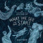 What We See in the Stars: An Illustrated Tour of the Night Sky
 The Stars Night by Night
 Madhouse at the End of the Earth: The Belgica`s Journey into the Dark Antarctic Night
 The Night Before the Night Before Christmas
 The Queen & Mr Brown: A Night in the Natural History Museum
 Night Sky: Stargazing with the Naked Eye
 Earth from Space
 The Pie at Night: In Search of the North at Play
 Night-Night Peekaboo
 Day & Night: Outer Space: Explore the World Around the Clock
 It Would Be Night in Caracas
 Earth to Earth: A Natural History of Churchyards
 Northern Antarctic Peninsula UKAHT Wall Map
 Something of the Night
 Amazing Earth
 West with the Night
 The Chartologist – The Night Sky
 Thatcher Peninsula – South Georgia BAS Wall Map
 The Sunlit Night
 The Night Flower
 Untold Night and Day
 Red Sky At Night
 World Satellite Image NGS Wall Map ENCAPSULATED
 The Usborne Book of Night Time
 The Night Gardener