Disclosure : This site contains affiliate links to products. We may receive a commission for purchases made through these links.
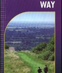
The Cumbria Way
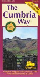
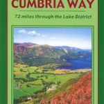
The waterproof Footprint map-guide to the Cumbria Way – the 73 mile (117km) route between Ulverstone and Carlisle. It generally follows well maintained paths and tracks through some of the Lake District`s finest scenery. This Footprint map is divided into 5 sections each portrayed on a separate panel. It is marked in miles, starting in Ulversyon. Text describing the route accompanies each section. 1:40,000; waterproof; GPS compatible; based on Ordnance Survey data.

Related Products:
 Cumbria Way (72 miles)
 Great Britain: Footprint Maps of Long-distance Hiking Routes
 Cumbria Way Harvey National Trail XT40
 West Cumbria, Cockermouth & Wast Water OS Landranger Active Map 89 (waterproof)
 Coast to Coast Walk Part 2 East – Swaledale to Robin Hood`s Bay
 Coast to Coast Walk Part 1 – St. Bees to Swaledale
 The C2C Cycle Route – Footprint Map-Guide to the 138 mile Sea to Sea Cycle Route
 West Cumbria 1925
West Cumbria 1901-1904
West Cumbria 1925
West Cumbria 1901-1904
 West Cumbria, Cockermouth & Wast Water OS Landranger Map 89 (paper)
 Pennine Bridleway: From Derbyshire through the Yorkshire Dales to Cumbria
 Cumbria Way Rucksack Reader
 North Cumbria & Dumfries 110K Sustrans Cycle Map No. 35
 The Three Peaks Challenge – Ben Nevis OS Explorer Map
 The Three Peaks Challenge – Snowdon OS Explorer Map
 Cumbria Way: Ulverston to Carlisle Main Route with Mountain Alternatives
 The Three Peaks Challenge – Scafell Pike OS Explorer Map
 Great Western Railway Map 1924: Paddinton to Penzance Wall Map (in Gold Tube)
 The West Highland Way – 95 Mile Route Between Milngavie and Fort William
 Rob Roy Way
 South Cumbria & The Lake District Sustrans Cycle Map 31
 Great Britain: Footprint Maps of Long-distance Cycling Routes
 Sea to Sea Cycle Route: Whitehaven/Workington – Newcastle/Sunderland
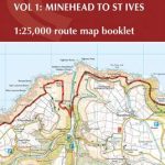 South West Coast Path 1 – Minehead to St Ives Cicerone Map Booklet
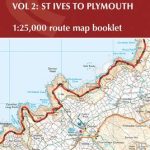 South West Coast Path 2 – St Ives to Plymouth Cicerone Map Booklet
 North Downs Way Harvey National Trail XT40
 Sherwood Forest & the East Midlands
 The Way of St. James to Compostela: Spanish Section
 Crimson Short Walks Guides
 Yorkshire 3 Peaks Challenge Minimaps Set: Pen-y-ghent, Whernside and Ingleborough
 Lake District & Cumbria Lonely Planet Planning Map
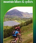 Coast to Coast West Mountain Bikers & Cyclists: St Bees to Kirkby Stephen
 National 3 Peaks Challenge Minimaps Set: Ben Nevis, Scafell Pike and Snowdon.
 The Dales Way Pocket Map-Guidermere – Ilkley to Bowness-on-Windermere
 Crimson Pathfinder Guides
 Short Walks in Cornwall
 Short Walks in Northumbria
 Short Walks in Dorset
 Great Glen Way Harvey National Trail XT40
 Cumbria & the Lake District – Drive & Stroll