Disclosure : This site contains affiliate links to products. We may receive a commission for purchases made through these links.
The Countyman`s Pocket Book

Related Products:
 Pocket Doodling and Colouring Book
 Holiday Pocket Puzzle Book
 Pocket Fashion Drawing Book
 Rainy Day Pocket Puzzle Book
 Holiday Pocket Doodling And Colouring Book
 Walker Books 3D Expanding City Skyline – Pocket Pop up Book
 Pocket Flyers Paper Airplane Book: 69 Mini Planes to Fold and Fly
 The Pirates Pocket-Book
 Pocket Quiz Book
 The New Pocket Kobbe`s Opera Book
 The Pocket Book Of Garden Experiments
 The Met Office Pocket Cloud Book
 Luxury Pocket Book Hiroshige Sea
 The Royal Navy Officer`s Pocket-Book
 Pocket Dangerous Book for Boys – Things to do
 Travel Pocket Doodling and Colouring Book
 The British Home Front Pocket-Book
 Oz Clarke`s Pocket Wine Book 2013
 Titanic: A Passenger`s Guide Pocket Book
 Luxury Pocket Book Hokusai Wave
 Luxury Pocket Book Hiroshige Meguro
 Luxury Pocket Book Klimt Three Ages
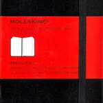 Moleskine Address Book Black Pocket
 Oz Clarke Pocket Wine Book: 7500 Wines, 4000 Producers, Vintage Charts, Wine and Food: 2015
 Pocket Dangerous Book for Boys – Wonders of the World
 New York 3D Expanding City Skyline – Pocket Pop up Book
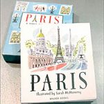 Paris 3D Expanding City Skyline – Pocket Pop up Book
 Washington D.C. 3D Expanding City Skyline – Pocket Pop up Book
 Dublin 3D Expanding City Skyline – Pocket Pop up Book
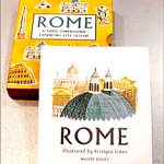 Rome 3D Expanding City Skyline – Pocket Pop up Book
 Berlin 3D Expanding City Skyline – Pocket Pop up Book
 Hugh Johnson`s Pocket Wine Book 2018
 Hugh Johnson`s Pocket Wine Book 2019
 The Metropolitan Museum of Modern Art 3D Expanding Guide – Pocket Pop up Book
 Bodleian Library: Hobbies and Pastimes Bookshelves (Foiled Pocket Book)
 Venice Pocket Precincts: A Pocket Guide to the City`s Best Cultural Hangouts, Shops, Bars and Eateries
 Lonely Planet Pocket Londra, London Pocket Guide (ITALIAN EDITION), IN ITALIANO
 The British Army Challenge Book: The must-have puzzle book for this Christmas!
 Max`s Picnic Book: An ode to the art of eating outdoors, from the authors of Max`s Sandwich Book
 Tokyo Pocket Precincts: A Pocket Guide to the City`s Best Cultural Hangouts, Shops, Bars and Eateries