Disclosure : This site contains affiliate links to products. We may receive a commission for purchases made through these links.
The Cleveland Way Cicerone Map Booklet
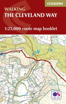
All the mapping you need to complete the Cleveland Way national trail. A long-distance route of 177 km (110 miles), giving around 9 days of easy and enjoyable walking through the North York Moors National Park, taking in open heather moorlands, gentle dales, interesting towns and villages, and dramatic cliff coastlines. This booklet of Ordnance Survey 1:25,000 Explorer maps has been designed for convenient use on the trail. It shows the full and up-to-date line of the national trail, along with the relevant extract from the OS Explorer map legend, and can be used when walking the route in either direction. It is conveniently sized for slipping into a jacket pocket or the top of a rucksack and comes in a clear PVC sleeve.

Related Products:
 The Dales Way Cicerone Map Booklet
 The Ridgeway Cicerone Map Booklet
 Two Moors Way Cicerone Map Booklet
 Speyside Way Cicerone Map Booklet
 South West Coast Path 1 – Minehead to St Ives Cicerone Map Booklet
 South West Coast Path 2 – St Ives to Plymouth Cicerone Map Booklet
 South West Coast Path 3 – Plymouth to Poole Cicerone Map Booklet
 The South Downs Way Map Booklet
 North Downs Way Cicerone Map Booklet
 Dales Way Map Booklet
 The Coast to Coast Cicerone Map Booklet
 Cotswold Way Cicerone Map Booklet
 Hadrian`s Wall Path Cicerone Map Booklet
 Offa`s Dyke Path Cicerone Map Booklet
 Pembrokeshire Coast Path Cicerone Map Booklet
 The Thames Path Cicerone Map Booklet
 Great Glen Way Cicerone Map Booklet
 West Highland Way Cicerone Map Booklet
 Pennine Way Cicerone Map Booklet
 Cleveland Way National Trail A-Z Wall Map
 Cleveland Way Harvey National Trail XT40
 Cicerone European Walking & Trekking Guides (Non UK and Ireland)
Great Britain: Cicerone Press Long-distance Paths Map Booklets
Cicerone European Walking & Trekking Guides (Non UK and Ireland)
Great Britain: Cicerone Press Long-distance Paths Map Booklets
 Cleveland Way: North York Moors – Helmsley to Filey
 Glyndwr`s Way A-Z National Trail Road Map
 The Ridgeway A-Z National Trail Road Map
 Cleveland Way and Yorkshire Wolds Way
 Cicerone Great Britain & Ireland Walking Guides
 Pennine Bridleway A-Z National Trail Road Map
 Cicerone World Walking & Trekking Guides (Non Europe, UK and Ireland)
 Cleveland Way A-Z Adventure Atlas
 Thames Path A-Z National Trail Road Map
 North Downs Way A-Z National Trail Road Map
 Cleveland Way
 John O`Groats Trail Harvey National Trail XT40
 Peddars Way & Norfolk Coast Path Harvey National Trail XT40
 Pennine Way North Harvey XT40 National Trail Map
 Walking Cheshire`s Sandstone Trail Northern Eye Books Map-Guide
 North Downs Way Harvey National Trail XT40
 Cicerone Great Britain & Ireland Cycling Guides