Disclosure : This site contains affiliate links to products. We may receive a commission for purchases made through these links.
The Cinema of Italy


Related Products:
 Italy: Directory of World Cinema
 Wild Swimming Italy – Discover the Most Beautiful Rivers, Lakes and Waterfalls of Italy
 My Secret Italy: A Girl`s Guide to Intimate Italy
 The Cinema of The Low Countries
 The Cinema of Germany
 The Cinema of Latin America
 The Cinema of Central Europe
 The Cinema of Britain & Ireland
 The Cinema of Spain & Portugal
 The Faber Book of New South America Cinema
 Italy: Tabacco 25K Walking Maps of the Dolomites and North-Eastern Italy
 Italy: Tabacco 50K Walking Maps of the Dolomites and North-Easterm Italy
 Italy: Edizioni Multigraphic 25K Walking Maps of Central Italy
 Italy: Kรผmmerly + Frey Outdoor Maps of Northern Italy
 Italy: IGC 50K Walking Maps of North-Western Italy
 Italy: Ed. Multigraphic Walking Maps of Central Italy
 Cinema of Scandinavia
 Maisy Goes to the Cinema
 Italy: Stanfords Map of Italy 1859 MEDIUM
 Italy: Stanfords Map of Italy 1859 SMALL
 Italy: IGA 50K Hiking Maps of Central Italy
 Italy: IGA 25K Hiking Maps of Central Italy
 Italy: SER 25K Hiking Maps of Central Italy
 Cinema of Australia & New Zealand
 Directory of World Cinema: Japan
 Directory of World Cinema: Australia & NZ
 Directory of World Cinema: Russia
 Cinema of Russia & the Former Soviet Union
 Directory of World Cinema: American Independent
 Directory Of World Cinema – East Europe
 Cinema of North Africa & the Middle East
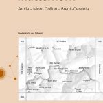
 The Bernina Tour: 12 Day Tour in Switzerland and Italy and Tour of Italy`s Valmalenco
 Italy
Italy
 Where to Ski in Italy
 The Best of Italy
 DK Eyewitness Italy
 A History of Italy
 A Literary Tour of Italy
 Italy Culture Shock!
 Italy – Culture Smart!