Disclosure : This site contains affiliate links to products. We may receive a commission for purchases made through these links.
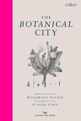
The Botanical City

Related Products:
 Royal Botanical Gardens Kew – The Tropical Hothouse: The Book That Turns Into a Botanical Paradise
 Tree Families: A Botanical Card Game
 The Botanical Kitchen: Cooking with Fruits, Flowers, Leaves and Seeds
Flowers That Thrive in London Gardens and Smoky Towns: A Victorian Botanical Handbook
The Botanical Kitchen: Cooking with Fruits, Flowers, Leaves and Seeds
Flowers That Thrive in London Gardens and Smoky Towns: A Victorian Botanical Handbook
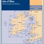
 Iceland Botanical Map
 Plant: Exploring the Botanical World
 Chilly`s Bottle Botanical Garden 500ml
 Chilly`s Bottle Botanical Cacti 500ml
 Chilly`s Bottle Botanical Fruit 500ml
 Glasshouse Greenhouse: Haarkon`s world tour of amazing botanical spaces
 The Plant-Hunter`s Atlas: A World Tour of Botanical Adventures, Chance Discoveries and Strange Specimens
 Explorers` Botanical Notebook: In the Footsteps of Theophrastus, Marco Polo, Linnaeus, Flinders, Darwin, Speke and Hooker
 City of Light, City of Poison: Murder, Magic, and the First Police Chief of Paris
 No Access New York City: The City`s Hidden Treasures, Haunts, and Forgotten Places
 The King`s City: London Under Charles II: A City That Transformed a Nation – And Created Modern Britain
 Where Can I Go? Big City Explorer: Amazing World City Maps and Facts
 Salt Lake City – Park City and the Wasatch Trail Map
 City Shapers London: The Creative People Shaping the City
 Medical London: City of Diseases, City of Cures
 City of Light, City of Poison
 CITIx60 City Guides – Taipei: 60 local creatives bring you the best of the city
 CITIx60 City Guides – Melbourne: 60 local creatives bring you the best of the city
 CITIx60 City Guides – Amsterdam: 60 local creatives bring you the best of the city
 CITIx60 City Guides – Stockholm: 60 local creatives bring you the best of the city
 New York City – Brooklyn – Long Island City Red Maps
 New York City – Manhattan Michelin City Plan and Index
VELO City: Bicycle Culture and City Life
New York City – Manhattan Michelin City Plan and Index
VELO City: Bicycle Culture and City Life
 Magnetic City: A Walker`s Companion to New York City
 Australia: Hema City to City Road Maps
 Baghdad: City of Peace, City of Blood
 Montreal & Quebec City Pocket Precincts: A Pocket Guide to the City`s Best Cultural Hangouts, Shops, Bars and Eateries
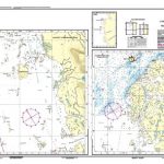
 NOAA Chart 18603 – St George Reef and Crescent City Harbor – Crescent City Harbor
 To The Last City
 Jar City
 City & The City
 No Mean City
 City Of God
 The City & The City
 In the City by the Sea
 King of the City