Disclosure : This site contains affiliate links to products. We may receive a commission for purchases made through these links.
Thailand, Vietnam, Laos & Cambodia ITMB Travel Atlas

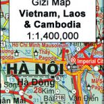
Thailand, Vietnam, Laos & Cambodia Travel Atlas at 1:1,100,000 from ITMB combining their individual coverage of these four countries into an indexed, handy A5 size paperback atlas with numerous street plans, enlargements, etcTopography is presented by bright altitude colouring , with spot heights and names of mountain ranges, etc. Additional graphics show swamps, mangrove, areas liable to inundation, wells, etc. National parks and other protected areas are prominently highlighted.Road network includes selected local roads, tracks and trails, with driving distances on main routes and locations of border crossings. Railway lines and ferry routes are included and domestic airports are marked. Also shown are internal administrative boundaries within each country with names of the province.The map indicates numerous places of interest, historic sites and natural curiosities, beaches and diving sites, etc. Various routes of the Ho Chi Minh Trail are highlighted. Latitude and longitude lines are drawn at intervals of 1ยฐ. Additional panels, usually placed on or near the appropriate map pages, show:Thailand: street plans of Bangkok with a further enlargement for its central area, plus central Chiang Mai and Pattaya.Vietnam: street plans of central Hanoi, Ho Chi Minh City (Saigon), Hue, Da Nang, Da Lat, Can Tho, and Hoi An; enlargements of the Hanoi and Hue areas; enlargements of Phu Quoc Island and Con Son Island: an administrative map of the country.Laos: street plan of central Vientiane and Louang Prabang Cambodia: street plan of Phnom Penh, an enlargement of the Siem Riep – Angkor Wat area highlighting locations of numerous temples, All street plans are annotated with selected accommodation, various facilities and places of interest.


