Disclosure : This site contains affiliate links to products. We may receive a commission for purchases made through these links.
Thailand ITMB
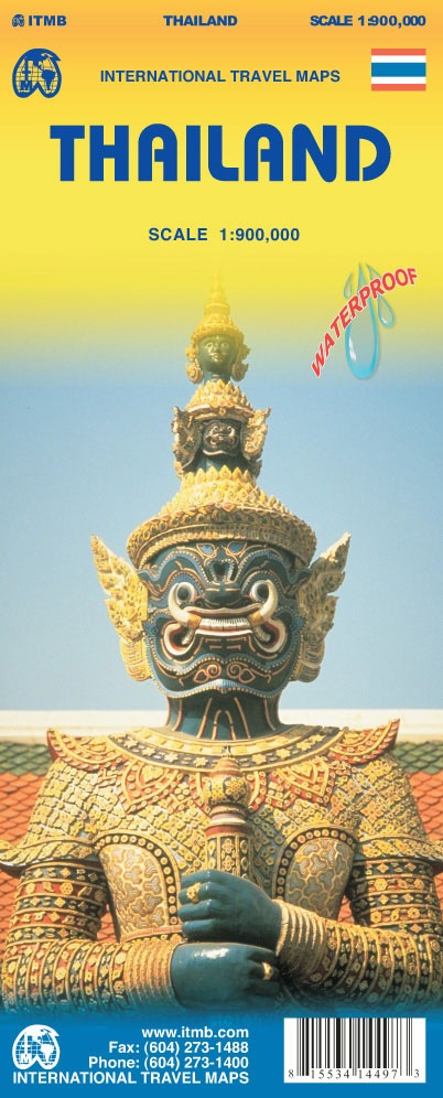
Thailand on an indexed, double-sided road map from ITMB, printed on light, waterproof and tear-resistant plastic paper, with street plans of central Bangkok, Chiang Mai and Pattaya highlighting main places of interest and selected accommodation.The map divides the country north/south to provide coverage at 1:900,000, but with no overlap between the two sides. Bangkok is included on the southern half, with coverage of the north starting at Phra Nakhon Si Ayutthaya, approximately 40km north of the capital. Elevation colouring with spot heights and graphics for mangrove areas show the topography. National parks and other protected areas are marked.The map shows the country’s road and rail networks, plus ferry connections to the islands and local airports. Symbols highlight various places of interest, including temples, archaeological sites, beaches and diving sites, viewpoints, etc. Also shown are the country’s administrative boundaries with names of the provinces. The map is indexed and has a latitude and longitude grid at intervals of 1ยบ.The map includes plans of central Bangkok, Chiang Mai and Pattaya highlighting various places of interest, numerous hotels, etc.

Related Products:
 Bangkok & Thailand South ITMB
 Thailand, Vietnam, Laos & Cambodia ITMB Travel Atlas
 Thailand Nelles
 Thailand North ITMB
 Thailand Periplus Travel Map
 Thailand Borch
 Bangladesh & India East ITMB
 Central and Eastern Thailand
 Thailand Handy Road Atlas
 Lima & Central Peru ITMB
 Auckland & North Island ITMB
 Northern Thailand
 Panama ITMB
 Myanmar / Burma Periplus Travel Map
 Peru ITMB
 Chiang Mai and Nearby Provinces
 North-Eastern Thailand
 Zambia & Eastern Africa ITMB Road Map
 Afghanistan ITMB
 Madagascar ITMB
Sri Lanka & India South ITMB
Madagascar ITMB
Sri Lanka & India South ITMB
 Helsinki & Southern Finland ITMB
 Bolivia ITMB
 Thailand Reise Know-How
 Osaka & Western Japan ITMB
 Mexico Border States: Coahuila, Nuevo Leon, Tamaulipas ITMB
 Kyoto & Japan West ITMB
 Malawi & Mozambique ITMB
 Central Asia ITMB
 Algeria ITMB
 South East Asia ITMB
 India North East & Kolkata / Calcutta ITMB
 Virgin Islands (US and British) ITMB
 Southern Thailand
 Colombia ITMB
 Paris & France North ITMB
 Hanoi – Vietnam North ITMB
New Zealand ITMB
Hanoi – Vietnam North ITMB
New Zealand ITMB