Disclosure : This site contains affiliate links to products. We may receive a commission for purchases made through these links.
Tettenhall 1900
Tettenhall in 1900 in a fascinating series of reproductions of old Ordnance Survey plans in the Alan Godfrey Editions, ideal for anyone interested in the history of their neighbourhood or family. The map covers most of Tettenhall, including Tettenhall Wood, west of Wolverhampton. Coverage extends from Tettenhall Upper Green southward to Compton Hall. Features include Tettenhall Wood House, Christ Church, Compton Hill, Elmsdale Hall, Dippons Farm, Long Lake, Tettenhall Towers, Tettenhall College, Manor House, Lower Green, Upper Green, Gorsty Hayes Manor House, Staffordshire & Worcestershire Canal, Compton, etc. On the reverse are 1912 directories of Tettenhall, Compton and Tettenhall Wood. About the Alan Godfrey Editions of the 25″ OS Series:Selected towns in Great Britain and Ireland are covered by maps showing the extent of urban development in the last decades of the 19th and early 20th century. The plans have been taken from the Ordnance Survey mapping and reprinted at about 15 inches to one mile (1:4,340). On the reverse most maps have historical notes and many also include extracts from contemporary directories. Most maps cover about one mile (1.6kms) north/south, one and a half miles (2.4kms) across; adjoining sheets can be combined to provide wider coverage.FOR MORE INFORMATION AND A COMPLETE LIST OF ALL AVAILABLE TITLES PLEASE CLICK ON THE SERIES LINK.

Related Products:
 Tamworth 1900
Shefford 1900 – 22.12
Wood Green 1912 – 7.3
Tamworth 1900
Shefford 1900 – 22.12
Wood Green 1912 – 7.3
 Wood Green 1894 – 7.2
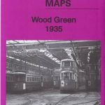 Wood Green 1935 – 7.4
 Swanage 1900
 Shrewsbury West 1900
Wolverhampton Bushbury 1914
Shrewsbury West 1900
Wolverhampton Bushbury 1914
 Mitcham 1910
Finchfield and Wightwick 1914
Mitcham 1910
Finchfield and Wightwick 1914
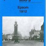 Epsom 1912
 Lisnaskea, Newtownbutler and The Upper Erne 1900
Hall Green 1903
Lisnaskea, Newtownbutler and The Upper Erne 1900
Hall Green 1903
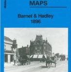 Barnet and Hadley 1896
 Upper Edmonton 1894 – 3a
Wylde Green 1913
Upper Edmonton 1894 – 3a
Wylde Green 1913
 Tong 1905
Theydon Bois 1915
Timperley 1897
Tong 1905
Theydon Bois 1915
Timperley 1897
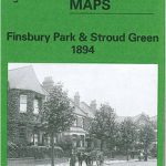 Finsbury Park and Stroud Green 1894
 Finsbury Park & Stroud Green 1870 – 20.1
Sturminster Newton 1900
Finsbury Park & Stroud Green 1870 – 20.1
Sturminster Newton 1900
 Finsbury Park & Stroud Green 1912 – 20.3
Talwrn 1910
Pedmore 1921
Finsbury Park & Stroud Green 1912 – 20.3
Talwrn 1910
Pedmore 1921
 Cheadle and Cheadle Heath 1897
Hopwood Hall and Thornham 1907
Cheadle and Cheadle Heath 1897
Hopwood Hall and Thornham 1907
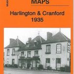 Harlington and Cranford 1935
Shaftesbury 1900
Leytonstone 1893 – 23.2
Hindley Green 1906
Harlington and Cranford 1935
Shaftesbury 1900
Leytonstone 1893 – 23.2
Hindley Green 1906
 Upper Sydenham 1894 – 137.2
 Northolt 1935
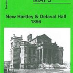 New Hartley and Delaval Hall 1896
Boothstown and Astley Green 1904
New Hartley and Delaval Hall 1896
Boothstown and Astley Green 1904
 Plumstead 1867
Leyland 1909
Gillingham (Dorset) 1900
Lostock Hall and Farington North 1909
Friern Barnet and New Southgate 1898
Plumstead 1867
Leyland 1909
Gillingham (Dorset) 1900
Lostock Hall and Farington North 1909
Friern Barnet and New Southgate 1898