Disclosure : This site contains affiliate links to products. We may receive a commission for purchases made through these links.
Terres de l`Ebre
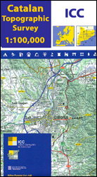
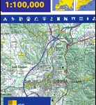
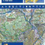
Terres de l`Ebre map at 1:100,000 in the topographic survey of Catalonia published by the Institut Cartogrร fic de Catalunya, with very detailed coverage of a large area and an excellent representation of the region’s topography. Maps in this series have relief presented by contours at 40m intervals, enhanced by additional hill-shading and spot heights; additional colouring shows different types of vegetation and boundaries of national parks and other protected areas are marked. Road network, graded into six types, prominently shows road numbers. Local tracks and paths are included and an overprint highlights long-distance footpaths, including the GR11. Symbols indicate various places of interest including youth hostels and mountain refuges, historical and cultural sites, recreational areas, etc. Four different types of interesting locations are highlighted, indicating picturesque towns or villages, individual isolated building or monuments, natural sites, and hydrographic features such as waterfalls. In the Pyrenees road and topographic information continues across the border in France, but the overprint for the GR routes and highlighting of places of interest is limited to the Spanish side. Each title also has a small administrative map of the region and a list of administrative units.The maps have a 10-km UTM grid, with latitude and longitude stated for the sheet corners. Main topographic legend is in Catalan only but the maps also have a separate tourist legend which includes English.To see the list of all the titles in this series please click on the series link.

Related Products:
 Pirineu Occidental
Comarques Centrales
Pla de Lleida
Camp de Tarragona
Pirineu Occidental
Comarques Centrales
Pla de Lleida
Camp de Tarragona
 Barcelona and Environs
 Pirineu Oriental – Girona – Costa Brava
Spain: 100K Catalan Topographic Survey
Pirineu Oriental – Girona – Costa Brava
Spain: 100K Catalan Topographic Survey
 Mรณra d`Ebre
 Delta de l`Ebre Parc Natural
Flix – Riba-roja d`Ebre
Delta de l`Ebre Parc Natural
Flix – Riba-roja d`Ebre
 Ribera d`Ebre
 Baix Ebre ICGC 09
 Gavarnie – Neouvielle – Luchonnais – Pic du Midi de Bigorre IGN 75019
Mora d`Ebre CNIG Topo 471
Gavarnie – Neouvielle – Luchonnais – Pic du Midi de Bigorre IGN 75019
Mora d`Ebre CNIG Topo 471
 Aragรณn Autonomous Region 300K CNIG Physical Road Map
 Catalonia Auotomous Community CNIG Physical Road Map
 Canary Islands Autonomous Region 350K CNIG Physical Road Map
 Cรฉvennes – Gorges du Tarn IGN 75011
 Perigord Noir – Haut-Quercy IGN 75026
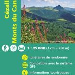 Cรฉzallier – Monts du Cantal IGN 75016
 Chartreuse – Belledonne IGN 75002
 Golfe du Morbihan – Belle-รle et Groix – Presqu`รle de Quiberon IGN 75017
 Chaรฎne des Puys – Massif du Sancy IGN 75015
 Pointe du Raz – Presqu`รฎle de Crozon – Ouessant – les Abers IGN 75024
 Kakheti – Tusheti Geoland Regional 1
 Guria-Imereti Geoland Regional 5
Adjara-Javakheti Geoland Regional 6
Guria-Imereti Geoland Regional 5
Adjara-Javakheti Geoland Regional 6
 Alt Empordรก 2-Map Set Editorial Alpina
Samegrelo-Svaneti Geoland Regional 4
Alt Empordรก 2-Map Set Editorial Alpina
Samegrelo-Svaneti Geoland Regional 4
 Basque Country IGN 75023
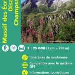 Massif des Ecrins – Oisans – Champsaur IGN 75006
Girona
Tortosa
Massif des Ecrins – Oisans – Champsaur IGN 75006
Girona
Tortosa
 Falset
 Brianรงonnais ‘“ Queyras IGN 75005
 Valles de Belagua y Roncal Editorial Alpina
 El Pont de Suert
Pla de la Llitera – Riu de Farfanya
Manresa – Pla de Bages
El Pont de Suert
Pla de la Llitera – Riu de Farfanya
Manresa – Pla de Bages
 La Bisbal d`Emporda