Disclosure : This site contains affiliate links to products. We may receive a commission for purchases made through these links.
Taunton 1886 – Colour Edition
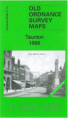
Taunton in 1886 in a fascinating series of reproductions of old Ordnance Survey plans in the Alan Godfrey Editions, ideal for anyone interested in the history of their neighbourhood or family. Two versions have been published for this area, providing good coverage of central Taunton and the area eastward to Holway Bridge and Holway Green. Features include town centre and the railway station, River Tone, Grand Western Canal, Bridgwater & Taunton Canal, Shire Hall, Shuttern Pridge, St John`s church, barracks, St George`s RC church, St Mary Magdalene`s church, Castle Green, Coal Orchard area, North Town area, St James church, Franciscan Convent, Taunton Workhouse, Lambrook Farm, Moor Farm, Taunton & Somerset Hospital, etc. The 1886 version is taken from the beautiful hand-coloured 1st Edition. Various directory extracts are on the reverse.About the Alan Godfrey Editions of the 25″ OS SeriesSelected towns in Great Britain and Ireland are covered by maps showing the extent of urban development in the last decades of the 19th and early 20th century. The plans have been taken from the Ordnance Survey mapping and reprinted at about 15 inches to one mile (1:4,340). On the reverse most maps have historical notes and many also include extracts from contemporary directories. Most maps cover about one mile (1.6kms) north/south, one and a half miles (2.4kms) across; adjoining sheets can be combined to provide wider coverage.FOR MORE INFORMATION AND A COMPLETE LIST OF ALL AVAILABLE TITLES PLEASE CLICK ON THE SERIES LINK.

Related Products:
 Dorchester 1886 – 40.15a Colour Edition
 Rothesay 1886 – 204.06
 Swanage 1900
Withington and Burnage 1892 (Colour edition)
South Chilterns 1886
Swanage 1900
Withington and Burnage 1892 (Colour edition)
South Chilterns 1886
 Palmers Green 1912 – 7.14a
Boothstown and Astley Green 1904
Barnsley 1890 (Colour Edition)
Northfield South 1903
Palmers Green 1912 – 7.14a
Boothstown and Astley Green 1904
Barnsley 1890 (Colour Edition)
Northfield South 1903
 Leeds North West 1889 (Colour Edition)
 Bromley Common and North-East Hayes 1895
Swindon (NW) 1899 – 15.03a
Swindon (NE) 1899 – 15.04a
Hindley Green 1906
Exeter 1888 – 80.06a Colour Edition
Bromley Common and North-East Hayes 1895
Swindon (NW) 1899 – 15.03a
Swindon (NE) 1899 – 15.04a
Hindley Green 1906
Exeter 1888 – 80.06a Colour Edition
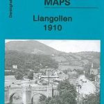 Llangollen 1910
Swindon South-West 1899
Swindon South-East 1899
Wollaston 1901 – 4.09
Wath upon Dearne 1901
Llangollen 1910
Swindon South-West 1899
Swindon South-East 1899
Wollaston 1901 – 4.09
Wath upon Dearne 1901
 Great Bridge and Toll End 1902
Paisley 1858 (Colour Edition)
Tettenhall 1900
Penryn 1906
Thame and District 1886
Rowley Regis and Blackheath 1902
Roding Valley and Epping Forest 1886
Houghton le Spring 1895
Brightlingsea 1895
Willenhall & Darlaston Green 1888 – 63.09a
Great Bridge and Toll End 1902
Paisley 1858 (Colour Edition)
Tettenhall 1900
Penryn 1906
Thame and District 1886
Rowley Regis and Blackheath 1902
Roding Valley and Epping Forest 1886
Houghton le Spring 1895
Brightlingsea 1895
Willenhall & Darlaston Green 1888 – 63.09a
 Hayes 1907
North Chorley 1909 – 77.08
Ruislip 1939
Hayes 1907
North Chorley 1909 – 77.08
Ruislip 1939
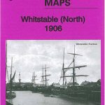 Whitstable (North) 1906 – 23.10
Shut End and Tansey Green 1903
Blackwater and Chelmer 1886
West Bromwich 1902 – 68.10b
Hornchurch 1915 – 79.15
Whitstable (North) 1906 – 23.10
Shut End and Tansey Green 1903
Blackwater and Chelmer 1886
West Bromwich 1902 – 68.10b
Hornchurch 1915 – 79.15
 Farnham 1913
Middlesbrough North 1893 (Colour Edition)
Farnham 1913
Middlesbrough North 1893 (Colour Edition)