Disclosure : This site contains affiliate links to products. We may receive a commission for purchases made through these links.
Tatra Tourist Attractions (Dookola Tatr)

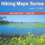
The Tatra Mountains in Poland and Slovakia on an overview road map at 1:100,000 from Cartomedia showing access to the mountains on both sides of the border and highlighting picturesque locations and other places of interest, plus street plans of Nowy Targ in Poland and Poprad and Liptovskรฝ Mikulรกลก in Slovakia. Coverage extends from Nowy Targ southwards to the northern part of the Lower Tatras national Park and Spisska Novรก Ves. Relief shading and colouring for woodlands shows the terrain. Road network indicates scenic routes, roads closed to cars, steep gradients, border crossings, locations of petrol stations, cars parks and bus stops. Driving distances are marked on main and most local routes. The map highlights main waymarked hiking trails indicating approximate timings in both directions. Also marked are recommended cycle routes and symbols indicate mountain huts, campsites and other tourist accommodation. Locations worth visiting are prominently highlighted. The map has latitude and longitude lines at 5’ intervals. Map legend includes English.On the reverse are street plans of Nowy Targ in Poland plus Poprad and Liptovskรฝ Mikulรกลก in Slovakia, a ski map of the Chopok area at 1:25,000, plus notes (in Polish only) about places worth visiting.PLEASE NOTE: to see the list of all the titles in this series which includes a more detailed coverage of the Tatra Mountains plus mapping of other regions southern Poland of please click on the series link.


