Disclosure : This site contains affiliate links to products. We may receive a commission for purchases made through these links.
Tatra Mountains ExpressMap Tourist Map
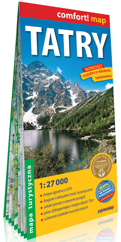
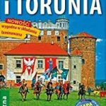
Tatras Mountains in a series covering Poland’s best hiking areas on waterproof and tear-resistant, laminated maps, specially designed to withstand repeated re-folding and even the worst weather conditions. Each map is double-sided and has clear, well presented cartography with a contoured base (20m interval) and, where appropriate, relief shading, graphic relief in rocky areas, and spot heights. Extensive overprint highlights waymarked hiking trails and on many titles also cycling, skiing or canoeing routes. Symbols show accommodation facilities including hotels, campsites, youth hostels, mountain refuges, etc., restaurants and bars in more remote areas, local bus stops, petrol stations, medical facilities, etc. Many titles include street plans of holiday resorts. The maps have either a UTM or latitude/longitude grid. *Map legend includes English.**In this title:* the whole of the Polish part of the Tatra Mountains, extending from Poronin in the north to just beyond the border with Slovakia. Overprint includes cross-country ski routes and downhill skiing areas. Areas with danger of avalanches are also marked. A separate inset indicates hiking times in both directions. Also included is a street plan of Zakopane at 1:15,000 plus an overview road map of the region at 1:160,000.

Related Products:
 Western Tatra Mountains Polish and Slovak ExpressMap Tourist Map
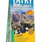 High and Bielskie Tatra Mountains – Polish and Slovak ExpressMap Tourist Map
 Swietokrzyskie Mountains ExpressMap Tourist Map
Sudetes West ExpressMap Tourist Map
Swietokrzyskie Mountains ExpressMap Tourist Map
Sudetes West ExpressMap Tourist Map
 Beskid Slaski ExpressMap Tourist Map
 Gรณry Stolowe ExpressMap Tourist Map
 Beskid Maly i Makowski ExpressMap Tourist Map
Sudetes Central ExpressMap Tourist Map
Klodzko Environs ExpressMap Tourist Map
Sudetes East ExpressMap Tourist Map
Beskid Maly i Makowski ExpressMap Tourist Map
Sudetes Central ExpressMap Tourist Map
Klodzko Environs ExpressMap Tourist Map
Sudetes East ExpressMap Tourist Map
 Beskid Zywiecki ExpressMap Tourist Map
 Beskid Niski ExpressMap Tourist Map
 Beskid Wyspowy ExpressMap Tourist Map
Krakรณw Environs ExpressMap Tourist Map
Warsaw Environs ExpressMap Tourist Map
Kampinoska Forest ExpressMap Tourist Map
Slowinski National Park ExpressMap Tourist Map
Suwalki Region ExpressMap Tourist Map
Bieszczady ExpressMap Tourist Map
Beskid Sadecki ExpressMap Tourist Map
Nadmorski Regional Park – Hel Peninsula ExpressMap Tourist Map
Beskid Wyspowy ExpressMap Tourist Map
Krakรณw Environs ExpressMap Tourist Map
Warsaw Environs ExpressMap Tourist Map
Kampinoska Forest ExpressMap Tourist Map
Slowinski National Park ExpressMap Tourist Map
Suwalki Region ExpressMap Tourist Map
Bieszczady ExpressMap Tourist Map
Beskid Sadecki ExpressMap Tourist Map
Nadmorski Regional Park – Hel Peninsula ExpressMap Tourist Map
 Gorce and Pieniny ExpressMap Tourist Map
Karkonosze ExpressMap Tourist Map
Gorce and Pieniny ExpressMap Tourist Map
Karkonosze ExpressMap Tourist Map
 Wolin Island – Wolinski National Park ExpressMap Tourist Map
 Bialowieska Forest – Bialowieza National Park ExpressMap Tourist Map
 Kaszuby – Kashubian Landscape Park ExpressMap Tourist Map
Mazury Lake District – Northern Part ExpressMap Tourist Map
Kaszuby – Kashubian Landscape Park ExpressMap Tourist Map
Mazury Lake District – Northern Part ExpressMap Tourist Map
 Bydgoszcz and Torun Environs ExpressMap Tourist Map
Mazury Lake District – Southern Part ExpressMap Tourist Map
Roztocze Central ExpressMap Tourist Map
Krakรณw-Czestochowa Jura – Northern Part ExpressMap Tourist Map
Bydgoszcz and Torun Environs ExpressMap Tourist Map
Mazury Lake District – Southern Part ExpressMap Tourist Map
Roztocze Central ExpressMap Tourist Map
Krakรณw-Czestochowa Jura – Northern Part ExpressMap Tourist Map
 Szczecin Environs ExpressMap Tourist Map
Krakow – Czestochowa Jura – Southern Part ExpressMap Tourist Map
Szczecin Environs ExpressMap Tourist Map
Krakow – Czestochowa Jura – Southern Part ExpressMap Tourist Map
 Mecsek – Villรกny Mountains Cartographia Tourist Map 15
Tatra Mountains Panorama ExpressMap Tourist Map
Tatra Mountains Polish and Slovak ExpressMap Tourist Map
Mecsek – Villรกny Mountains Cartographia Tourist Map 15
Tatra Mountains Panorama ExpressMap Tourist Map
Tatra Mountains Polish and Slovak ExpressMap Tourist Map
 Tatra Mountains PL/SK
 Poland: ExpressMap Hiking Maps
 Tatra Tourist Attractions (Dookola Tatr)
 Polish and Slovak Tatra Mountains