Disclosure : This site contains affiliate links to products. We may receive a commission for purchases made through these links.
Tallis Map of London 1851

Fully titled Tallis’s Illustrated Plan of London and its Environs, this reproduction map measures 76x56cm. It was originally published in 1851 to mark that year’s Great Exhibition of Industry of all Nations, the location of which is marked in Hyde park on the map. Coverage extends from Fulham in the south west to Leyton Marsh in the north east. Hachuring (a style of hill-shading) emphasises the significant hills eg. in Greenwich Park and Hampstead Heath. Unobtrusively superimposed on the map is a 3 mile radius circle, centred approximately on Newgate Street near St Paul’s Cathedral. Around the margins of the sheet are small images of London landmarks.

Related Products:
 Balloon View of London, 1851
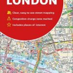 London Collins Handy Street Map
 Photographing London: 2: Volume 2: Outer London & Secrets of Street Photography
 Hampstead 1866 – 27.1
 Hampstead 1915 – 27.3
 London: Edward Mogg`s 24 Miles c. 1851 MEDIUM
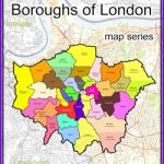
 London Parks
 London Collins Pocket Atlas
 Walking in London: Park, Heath and Waterside Walks – 25 walks in London`s green spaces
 London National Park City – Greenwich Map
 Curiocity F – Fictional London
 50 Classic Cycle Climbs: London & South East
 Escaping London Pocket Map/Guide: a Pre-Raphaelite Pilgrimage Route
 A Circular Walk Though Highgate, Hampstead and Hampstead Heath: Section 2 – Highgate Village to Parliament Hill Fields
 London Guy Fox Children`s Map
Blackheath & Greenwich Park 1894 – 105.2
London Guy Fox Children`s Map
Blackheath & Greenwich Park 1894 – 105.2
 Birdwatching London: All the Best Places to See Birds in the Capital
 The Heath: My Year on Hampstead Heath
 What Abigail Did That Summer: A Rivers Of London Novella
 London Children`s Map (FRENCH LANGUAGE)
 London: Edward Mogg`s 24 Miles c. 1851 SMALL
 Balloon View of London
 London Red Maps
 Blackheath 1914 – 105.3
 Time Out London Walks – Volume 1
 London: A New Map of London by Robert Laurie & James Whittle c.1800 MEDIUM
 London: Greenwich Borough Map – Stanfords Print on Demand
London: Vicinity of London c.1847 MEDIUM
London: Greenwich Borough Map – Stanfords Print on Demand
London: Vicinity of London c.1847 MEDIUM
 The London Scene
 London: Vicinity of London c.1847 SMALL
 London: Cruchley`s 12 Miles Round London c.1826 SMALL
London: Cruchley`s 12 Miles Round London c.1826 MEDIUM
London: Cruchley`s 12 Miles Round London c.1826 SMALL
London: Cruchley`s 12 Miles Round London c.1826 MEDIUM
 London A-Z Map
 Stanford`s Map of the County of London (1888) – A3 Wall Map, Paper
Stanford`s Map of the County of London (1888) – A3 Wall Map, Canvas
Stanford`s Map of the County of London (1888) – A2 Wall Map, Paper
Stanford`s Map of the County of London (1888) – A2 Wall Map, Canvas
Stanford`s Map of the County of London (1888) – A1 Wall Map, Canvas
Stanford`s Map of the County of London (1888) – A3 Wall Map, Paper
Stanford`s Map of the County of London (1888) – A3 Wall Map, Canvas
Stanford`s Map of the County of London (1888) – A2 Wall Map, Paper
Stanford`s Map of the County of London (1888) – A2 Wall Map, Canvas
Stanford`s Map of the County of London (1888) – A1 Wall Map, Canvas
 London High 5 Edition Street Plan
Thomas Milne`s Land Use Map of London & Environs in 1800
London High 5 Edition Street Plan
Thomas Milne`s Land Use Map of London & Environs in 1800