Disclosure : This site contains affiliate links to products. We may receive a commission for purchases made through these links.
Tรผbingen – Reutlingen

One of the titles in a series of double-sided topographic maps with hiking routes and tourist information. Cartography is identical to the standard topographic survey of Germany, with contours at 10m intervals. Extensive overprint highlights numerous local footpaths and long-distance hiking routes, indicating waymarking. Cycling routes, mountain bike centres and trails, and cross-country ski routes are also marked. Extensive range of symbols highlight sport and leisure facilities, various types of accommodation, places of interest, tourist railways, etc. Boundaries of national parks and nature reserves are marked. The maps have a 2km UTM grid. Map legend includes English. The maps also have lists of contact details of various organizations and facilities within the region, plus brief descriptions in German only.

Related Products:
 Heilbronn
 Gรถppingen
Pforzheim
Offenburg
Freudenstadt
Lรถrrach
Singer
Crailsheim
Bad Urach
Sigmaringen
Bad Saulgau
Bad Mergentheim F515
Gรถppingen
Pforzheim
Offenburg
Freudenstadt
Lรถrrach
Singer
Crailsheim
Bad Urach
Sigmaringen
Bad Saulgau
Bad Mergentheim F515
 Tรผbingen / Reutlingen – Stuttgart South Cycling Map
 Baden-Baden
Titisee-Neustadt
Villingen-Schwenningen
Waldshut-Tiengen
Biberach an der Riss
Wangen im Allgรคu
Unteres Taubertal – Tauberbischofsheim F512
Karlsruhe – Rhein – Kraichgau F516
Baden-Baden
Titisee-Neustadt
Villingen-Schwenningen
Waldshut-Tiengen
Biberach an der Riss
Wangen im Allgรคu
Unteres Taubertal – Tauberbischofsheim F512
Karlsruhe – Rhein – Kraichgau F516
 Aalen – Hรคrtsfeld – Ostalb F522
Mosbach – Buchen F514
Mannheim – Heidelberg F513
Aalen – Hรคrtsfeld – Ostalb F522
Mosbach – Buchen F514
Mannheim – Heidelberg F513
 Ulm – Blaubeuren – Donau F525
Freiburg im Breisgau – Kaiserstuhl
Lake Constance West
Lake Constance East
Swabian-Franconian Forest – Schwรคbisch Hall 518
Stuttgart
Germany: Baden-Wรผrttemberg 50K Topographic Survey Leisure Maps
Ulm – Blaubeuren – Donau F525
Freiburg im Breisgau – Kaiserstuhl
Lake Constance West
Lake Constance East
Swabian-Franconian Forest – Schwรคbisch Hall 518
Stuttgart
Germany: Baden-Wรผrttemberg 50K Topographic Survey Leisure Maps
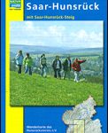 Saar-Hunsrรผck Nature Park East
 Germany: Hesse 50K Topographic Survey Leisure Maps
 Finland East Karttakeskus Road Map
Finland North Karttakeskus Road Map
Finland East Karttakeskus Road Map
Finland North Karttakeskus Road Map
 Finland West Karttakeskus Road Map
Finland South Karttakeskus Road Map
Finland West Karttakeskus Road Map
Finland South Karttakeskus Road Map
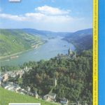
 Germany: Rhineland-Palatinate 50K Topographic Survey Recreational Maps
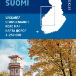
Finland: Karttakeskus 250/400K GT Road Maps
Germany: Rhineland-Palatinate 50K Topographic Survey Recreational Maps
Finland: Karttakeskus 250/400K GT Road Maps
 Kurhessisches Bergland