Disclosure : This site contains affiliate links to products. We may receive a commission for purchases made through these links.
Syria – Lebanon

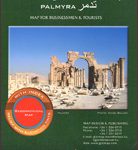
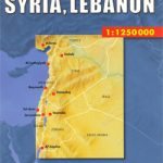
Syria and Lebanon on an indexed road map with large insets with street plans of Damascus, Aleppo and Beirut, a plan of the archaeological remains at Palmyra, plus an administrative map of both countries.Road and rail networks are presented on a base with plenty of topographic information: sandy and rocky deserts, lava fields, salt pans, seasonal rivers, names of mountain ranges and valleys, etc. Many cross-desert tracks are included. Driving distances are marked on main routes and border crossings to the neighbouring countries are shown, as well as internal administrative boundaries, with a separate inset showing administrative provinces with their names. Both countries’ main historical sites are highlighted. Golan Heights are shown with pre-1967 boundary and both the ceasefire line and the demilitarized zone are marked. The map has latitude and longitude lines at intervals of 1ยฐ and an index on the reverse side. Map legend includes English.Insets with street plans of Damascus, Aleppo and Beirut cover more than just the very central part of each city and indicate locations of selected hotels. Also included is a plan of the archaeological site at Palmyra.


