Disclosure : This site contains affiliate links to products. We may receive a commission for purchases made through these links.
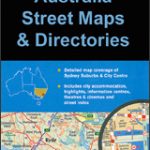
Sydney & Australia East ITMB
A clear, indexed street plan of Sydney at 1:10,000 from ITMB, printed on light, waterproof and tear-resistant synthetic paper, with diagrams of its rail and ferry networks plus road map of the city’s environs. On the reverse is an indexed road map of the eastern half of Australia extending west to Alice Springs, plus street plans of central Melbourne and Brisbane.On one side is a clearly drawn street plan of the city, with an inset extending it across the Sydney Harbour Bridge to cover part of North Sydney. The main plan extends south beyond the Central Station to the Newtown Station and the Sydney Cricket Ground. Highways and other principal traffic arteries are highlighted and one way streets are marked. The plan also indicates lines and stations of the metro and rail network, plus ferry connections within the harbour. Important buildings and facilities, including selected hotels are highlighted and named. The plan is indexed and is accompanied by a road map of the city’s environs plus two diagrams: CityRail and ferries.On the reverse is an indexed road map of the western half of Australia at 1:3,500,000 extending west to Alice Springs (but not to Ayres Rock / Uluru). Topography is shown by light altitude colouring with bands in feet and spot heights given in feet and metres. The map shows the country’s road network with names of highways and driving distances on main routes. Places of tourist interest are marked. Latitude and longitude lines are drawn at 2ยบ intervals. Accompanying plans of central Melbourne and Brisbane have similar presentation to the plan of Sydney.


