Disclosure : This site contains affiliate links to products. We may receive a commission for purchases made through these links.
Switzerland K+F Activity Map
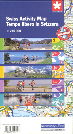
Activity Map of Switzerland from Kรผmmerly + Frey on light, waterproof and tear-resistant plastic paper, highlighting national and regional long-distance hiking, cycling, mountain biking, roller skating and canoeing routes, plus rafting sites.The map provides essential information for anyone planning an outdoor leisure holiday in Switzerland, with its extensive overprint distinguishing between the national and the regional routes, all shown with their official numbers. The publishers’ road map of the country used as a base has relief shading to show the topography, with plenty of names of mountain ranges, peaks, glaciers, valleys, etc. The map has latitude and longitude lines drawn at 10’ and 15’ respectively. Map legend includes English. On the reverse is an index showing all the localities with postcodes, plus a list of all the national and regional hiking, cycling, mountain biking, roller skating and canoeing routes highlighted on the map.

Related Products:
 Switzerland K+F Cycling Map
 Switzerland K+F Long-Distance Hiking Routes Map
 Switzerland 200K DOUBLE-SIDED
 Switzerland Swisstopo National Map
 Switzerland 3in1 Flash Guide
 Switzerland: Ice & Glaciers Once and Today Swisstopo Map No. 306
 Switzerland: Hallwag 50K Outdoor Maps
 Switzerland: Hallwag 50K Mountain Biking Maps
 Switzerland 500K Swisstopo 0070
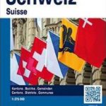 Switzerland K+F Administrative Map
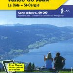 Switzerland: Kรผmmerly + Frey 60K Walking Maps
 Switzerland Borch
 Switzerland Hallwag Motorcycle Map Set
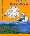 Switzerland: Michelin 200K Road Maps
 Franconian Switzerland South Kompass 171
 Switzerland, My Holiday Map
 Franconian Switzerland – Wiesenttal – Pottenstein K+F Outdoor Map 37
 Switzerland: Swiss Survey 25K Topographic Maps
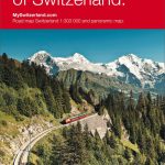
Switzerland Hallwag New Travel Map
Switzerland: Swiss Survey 25K Topographic Maps
Switzerland Hallwag New Travel Map
 Franconian Switzerland Regional Park – Veldensteiner Forst North
 Franconian Switzerland Regional Park – Veldensteiner Forst South
Long-Distance Cycling Routes Austria – Switzerland – Italy GERMAN
Saxon Switzerland – Western Oberlausitz Kompass 810
North Franconian Switzerland – Bayreuth – Bamberg – Coburg Kompass 165
Franconian Switzerland Regional Park – Veldensteiner Forst South
Long-Distance Cycling Routes Austria – Switzerland – Italy GERMAN
Saxon Switzerland – Western Oberlausitz Kompass 810
North Franconian Switzerland – Bayreuth – Bamberg – Coburg Kompass 165
 Beer Hiking Switzerland: The Most Refreshing Way to Discover Switzerland
 Walking in the Engadine – Switzerland: Bernina, Engadine valley and Swiss National Park
 Switzerland: Swiss Survey 50K/33K Hiking Editions of Topographic Maps
 Switzerland: Kรผmmerly + Frey 60K Cycling Maps
 Switzerland: Hallwag 50K Hiking Atlases
Switzerland North Michelin Regional 551
Switzerland South-West Michelin Regional 552
Switzerland South-East Michelin Regional 553
Switzerland: Hallwag 50K Hiking Atlases
Switzerland North Michelin Regional 551
Switzerland South-West Michelin Regional 552
Switzerland South-East Michelin Regional 553
 Cantabria Autonomous Community CNIG Physical Road Map
Tectonic Map of Switzerland
Cantabria Autonomous Community CNIG Physical Road Map
Tectonic Map of Switzerland
 Extremadura Auotomous Community CNIG Physical Road Map
 Switzerland Insight Travel Map
Murcia Autonomous Region 200K CNIG Physical Road Map
Castilla-la-Mancha Autonomous Region 400K CNIG Physical Road Map
Switzerland Insight Travel Map
Murcia Autonomous Region 200K CNIG Physical Road Map
Castilla-la-Mancha Autonomous Region 400K CNIG Physical Road Map
 Switzerland 300K Swisstopo 0050
 Castilla y Leon Autonomous Community CNIG Physical Road Map