Disclosure : This site contains affiliate links to products. We may receive a commission for purchases made through these links.
Switzerland: Kรผmmerly + Frey 120K Holiday Maps
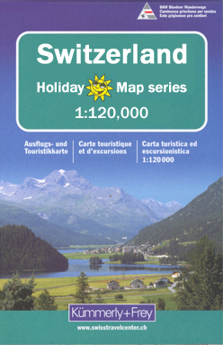
Switzerlandโ€s four main hiking areas: Bernese Oberland, Valais/Wallis, Graubรผnden with the Engadine Valleys, and the canton of Ticino on contoured and GPS compatible maps at 1:120,000 from Kรผmmerly + Frey, excellent for planning walking holidays. The maps have contours at 100-metre intervals, enhanced by shading and graphic relief to provide a vivid presentation of the terrain. An overprint highlighting walking trails distinguishes between hiking paths, more strenuous mountain routes and alpine sections. Symbols indicate locations of mountain huts, Friends of Nature houses, youth hostels, campsites and selected isolated inns, interesting natural curiosities, etc. Picturesque towns or villages are prominently highlighted and the maps also show roads with public transport facilities plus, of course, railways and all forms of mountain transport (cable cars, chair lifts, etc). The maps have Swiss national grid lines at 5km intervals. Map legend includes English.

Related Products:
 Switzerland: Kรผmmerly + Frey 60K Walking Maps
 Graubรผnden Holiday Map
 Bernese Oberland Holiday Map
 Switzerland: Kรผmmerly + Frey 60K Cycling Maps
 Italy: Kรผmmerly + Frey Outdoor Maps of Northern Italy
 Germany: Kรผmmerly+Frey Hiking and Recreational Maps
 Austria: Kรผmmerly+Frey Recreational Maps
 Italy: Kรผmmerly + Frey 200K Regional Road Maps
 Germany: Kรผmmerly+Frey 275K Regional Road Map
 Switzerland: Hallwag 50K Mountain Biking Maps
 Switzerland: Hallwag 50K Outdoor Maps
 Lower Rhine – Kleve – Wesel 50K Kรผmmerly + Frey Map No. 61
 Fichtelgebirge 35K Kรผmmerly + Frey Map No. 36
 Austria: Freytag & Berndt Hiking Maps
 Switzerland: Hallwag 50K Hiking Atlases
 Flensburg – Schleswig 50K Kรผmmerly + Frey Map No. 9
 Hochsauerland – Rothaargebirge 50K Kรผmmerly + Frey Map No. 30
 Lรผbeck – Wismar 50K Kรผmmerly + Frey Map No. 12
 Porta Westfalica – Minden 50K Kรผmmerly + Frey Map No. 58
Swabian Jura: Mรผnsinger Alb 35K Kรผmmerly + Frey Map No. 42
Black Forest: Triberg 35K Kรผmmerly + Frey Map No. 40
Porta Westfalica – Minden 50K Kรผmmerly + Frey Map No. 58
Swabian Jura: Mรผnsinger Alb 35K Kรผmmerly + Frey Map No. 42
Black Forest: Triberg 35K Kรผmmerly + Frey Map No. 40
 Usedom Island 50K Kรผmmerly + Frey Map No. 15
 Mรผnsterland Ost – Beckumer Berge 50K Kรผmmerly + Frey Map No. 59
 Fischland – Darร – Kรผhlungsborn 50K Kรผmmerly + Frey Map No. 13
 Black Forest: Freudenstadt 35K Kรผmmerly + Frey Map No. 39
 Swabian Jura: Hohenzollern 35K Kรผmmerly + Frey Map No. 41
 Odenwald – Heidelberg – Bergstrasse 35K Kรผmmerly + Frey Map No. 35
 Pfรคlzerwald (Palatinate Forest) 50K Kรผmmerly + Frey Map No. 24
 Eifel West – Schneifel 35K Kรผmmerly + Frey Map No. 34
 Spreewald – NP Dahme-Heideseen 50K Kรผmmerly + Frey Map No. 29
 Kiel – Groรer Plรถner See 50K Kรผmmerly + Frey Map No. 10
Naturpark Mass – Schwalm – Nette 50K Kรผmmerly + Frey Map No. 62
Kiel – Groรer Plรถner See 50K Kรผmmerly + Frey Map No. 10
Naturpark Mass – Schwalm – Nette 50K Kรผmmerly + Frey Map No. 62
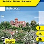
 Spessart North – Bad Orb – Steinau – Burgsinn 35K Kรผmmerly + Frey Map No. 49
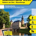 Hohe Mark / Mรผnsterland West 50K Kรผmmerly + Frey Map No. 60
 Lower Middle Rhine: Bonn to Koblenz 35K Kรผmmerly + Frey Map No. 31
 World: Kรผmmerly + Frey Political Wall Maps
 Austria: Freytag & Berndt 150K “Top 10 Tips” Road Maps
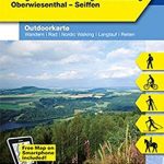 Erzegebirge – Klingenthal – Altenberg – Fichtelberg – Oberwiesenthal – Seiffen 50K Kรผmmerly + Frey Map No. 48
 Fehmarn Island – The Baltic Coast of Schleswig-Holstein 50K Kรผmmerly + Frey Map No. 11
 Switzerland: Swiss Survey 50K/33K Hiking Editions of Topographic Maps