Disclosure : This site contains affiliate links to products. We may receive a commission for purchases made through these links.
Switzerland: Ice & Glaciers Once and Today Swisstopo Map No. 306
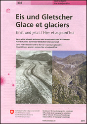
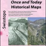
Ice and Glaciers map in the Swisstopo’s ‘Once and Today” series, presenting on one side a map of Switzerland during the Last Glacial Maximum, with on the reverse topographic maps and aerial photos of the country’s five well-known glaciers to show the extent of the retreat of the ice cover. On one side is a map of the whole country at 1:540,000 during the Last Glacial Maximum 20,000 to 11,500 years ago. The map has contours at 200m intervals both on the glaciers and the ice-free area and shows names numerous mountain peaks as well as locations of present day main towns. On the reverse five of the country’s well known glaciers: the Great Aletsch Glacier, the Trift Glacier, the Lower Grindelwald Glacier, the Morteratsch Glacier and the Gorner Glacier near Zermatt, are each shown on two topographic maps, from present day and from mid-1800s, plus on two aerial photos.Map legend and the accompanying text include English.For the list of other titles in this series please click on the series link.

Related Products:
 Map of the Glaciers of Iceland
 Berne Once and Today Swisstopo Map No. 301
 Geneva Once and Today Swisstopo Map No. 303
 Zurich Once and Today Swisstopo Map No. 304
 Basel Once and Today Swisstopo Map No. 302
 Switzerland: Swisstopo “Once and Today” Historical Maps
 Endangered: From Glaciers to Reefs
 Sasso San Gottardo Once and Today Swisstopo Map No. 305
 Switzerland North East Swisstopo 2
 Switzerland South East Swisstopo 4
 Mount Gongga Glaciers
 Switzerland North West Swisstopo 1
 Switzerland South West Swisstopo 3
 Thuner See – Central Switzerland Swisstopo 101
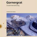 Zermatt – Gornergrat Swisstopo 2515
 Zermatt – Saas-Fee – Matterhorn – Gornergrat – Mittelallalin Swisstopo Hiking 3306T
 Switzerland 300K Swisstopo 0050
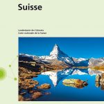 Switzerland Swisstopo National Map
 Zermatt Swisstopo 1348
 Valais / Wallis Swisstopo 105
 Switzerland K+F Administrative Map
 Switzerland Castles Map – West Swisstopo 9801
 Switzerland 500K Swisstopo 0070
 Gotthard Railway Axis Once & Today Swisstopo Map No. 307
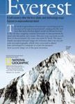 Mount Everest 50th Anniversary NGS Wall Map
 Saas-Fee Swisstopo 2526
 Busen Region – South Georgia BAS
 Switzerland 200K DOUBLE-SIDED
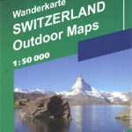 Switzerland: Hallwag 50K Outdoor Maps
 Aletschgletscher Swisstopo 1269
 Finsteraarhorn Swisstopo 1249
 North Fork – Glacier National Park MT NGS Trails Illustrated Map 313
 Trekking in the Vanoise: Tour of the Vanoise and the Tour des Glaciers de la Vanoise
 Many Glacier – Glacier and Waterton Lakes National Parks MT
 Mischabel Swisstopo 284
 Zurich & Switzerland NW ITMB
 Mischabel Swisstopo Hiking 284T
 Philippines Odyssey Map
 Switzerland: Swiss Survey 200K Topographic Maps
 While the Fires Burn: A Glacier Odyssey