Disclosure : This site contains affiliate links to products. We may receive a commission for purchases made through these links.
Swiss Cottage & South Hampstead 1937 – 37.4
Swiss Cottage and South Hampstead in 1937 in a fascinating series of reproductions of old Ordnance Survey plans in the Alan Godfrey Editions, ideal for anyone interested in the history of their neighbourhood or family. Three versions of this map have been published, centred on Swiss Cottage with its underground station, New College (a training college for dissenting ministers), and School for the Blind. The map also covers West Hampstead, and the area of south and west Hampstead developed as part of the Maryon Wilson estate. It also includes part of the Belsize estate. In the north-eastern part of the map is a stretch of Haverstock Hill, including Hampstead Vestry Hall; in the south-eastern corner is part of Primrose Hill, while Edgware Road cuts across the south-western corner. Several railways emerge from tunnels on the map, including the LNWR at Loudon Road station, and Metropolitan, Midland and Hampstead Junction at the Finchley Road stations. Principal roads include Priory Road, Finchley Road, Fitzjohns Avenue, Eton Avenue, Adelaide Avenue and many more. The 1871 map shows an area which is still largely undeveloped north of Swiss Cottage. This map includes extracts from an early street directory for Adelaide Road, Belsize Road/Square, Finchley New Rd and Loudon Road. The 1937 map, by contrast, shows the area entirely built up. Its selection of street directory entries on the reverse includes Belsize Avenue/Crescent/Grove/Lane, Elsworthy Road, Finchley Road, Fitzjohns Avenue and Greencroft Gardens. About the Alan Godfrey Editions of the 25″ OS Series:Selected towns in Great Britain and Ireland are covered by maps showing the extent of urban development in the last decades of the 19th and early 20th century. The plans have been taken from the Ordnance Survey mapping and reprinted at about 15 inches to one mile (1:4,340). On the reverse most maps have historical notes and many also include extracts from contemporary directories. Most maps cover about one mile (1.6kms) north/south, one and a half miles (2.4kms) across; adjoining sheets can be combined to provide wider coverage.FOR MORE INFORMATION AND A COMPLETE LIST OF ALL AVAILABLE TITLES PLEASE CLICK ON THE SERIES LINK.

Related Products:
 Swiss Cottage 1866-71 – 37.1
East Finchley & Hampstead Garden Suburb 1894-1911 – 10.3
Swiss Cottage 1866-71 – 37.1
East Finchley & Hampstead Garden Suburb 1894-1911 – 10.3
 Hampstead 1866 – 27.1
 Hampstead 1915 – 27.3
 Trafford Park South 1937
 Finchley and Holders Hill 1895
 South Acton & Gunnersbury Park 1935 – 71.4
 Hampstead and Belsize Park Then & Now
Hendon 1895
Hampstead and Belsize Park Then & Now
Hendon 1895
 Mid Finchley 1934
 Mid Finchley 1911
 East Finchley 1894 – 10.2
 Cricklewood and Child`s Hill 1912
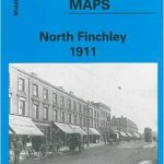 North Finchley 1911
North Finchley 1894
North Finchley 1911
North Finchley 1894
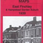 East Finchley & Hampstead Garden Suburb 1939 – 10.4
A Circular Walk Though Highgate, Hampstead and Hampstead Heath: Section 2 – Highgate Village to Parliament Hill Fields
East Finchley & Hampstead Garden Suburb 1939 – 10.4
A Circular Walk Though Highgate, Hampstead and Hampstead Heath: Section 2 – Highgate Village to Parliament Hill Fields
 South Harrow and Northolt Park 1935
Barnsley South East 1904
South Harrow and Northolt Park 1935
Barnsley South East 1904
 Alexandra Park and South Friern 1935
 Alexandra Park & South Friern 1894 – 6a
 Alexandra Park & South Friern 1911 – 6b
Billingham South 1939
Longbridge 1937
Durham City South 1897
Alexandra Park & South Friern 1911 – 6b
Billingham South 1939
Longbridge 1937
Durham City South 1897
 Kilburn & West Hampstead Past
 South Croydon 1895 – 14.14
 South Croydon 1895 – 159.2
Worcester South-East 1902
South Croydon 1895 – 159.2
Worcester South-East 1902
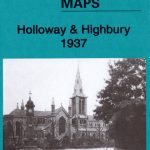 Holloway & Highbury 1937 – 29.4
Doncaster South 1928 – 285.01b
Holloway & Highbury 1937 – 29.4
Doncaster South 1928 – 285.01b
 Sedgley South-East with Swan Village and West Coseley 1901
Chigwell Row and Grange Hill 1914
Birmingham South 1913
Sedgley South-East with Swan Village and West Coseley 1901
Chigwell Row and Grange Hill 1914
Birmingham South 1913
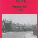 Muswell Hill 1935 – 11.4
Swindon South-West 1899
Muswell Hill 1935 – 11.4
Swindon South-West 1899
 Muswell Hill 1913 – 11.3
Swindon South-East 1899
Muswell Hill 1913 – 11.3
Swindon South-East 1899
 Darlington (South) 1898 – 55.10a
Sunderland South 1895
Darlington (South) 1898 – 55.10a
Sunderland South 1895