Disclosure : This site contains affiliate links to products. We may receive a commission for purchases made through these links.
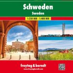
Sweden Norstedts Road Atlas 2021
In addition to detailed tourist information in the map section, the Auto Atlas contains 50 city maps, distance tables, an overview map with charging stations, an overview map for Stockholm and much more. A detailed register with 33,700 entries opens up this practical travel companion .The map image includes: Roads, Routes, Distances, Railways, Ferries, Places, Rivers, Lakes, Elevation Points, Landscapes highlighted in color, National Parks, Campgrounds, Youth Hostels, Rest Area, Bathing Points, Viewpoints, Hiking Trails, Golf Courses, Ski Lifts, Landmarks.In addition, this Swedish auto atlas contains 50 city maps: Boden , Borlรคnge , Borรฅs , Eskilstuna , Falun , Gรคvle , Gothenburg , Halmstad , Helsingborg , Hรคrnรถsand , Jonkรถping , Kalmar , Karlsskoga , Karlskrona , Karlstad , Kiruna , Kristianstad , Landskrona , Lidkรถping , Linkรถping , Luleรฅ , Lund, Malmรถ , Motala , Norrkoping , Norrtรคlje , Nykรถping , Sandviken , Skara , Skellefteรฅ , Skรถvde , Stockholm , Sundsvall , Sรถerhamn , Sรถdertรคlje , Trelleborg , Trollhรคttan , Uddevalla , Umeรฅ , Uppsala , Varberg , Visby , Vรคnersborg , Vรคxjรถ , Ystad , ร–rebro, ร–rnskรถldsvik , ร–stersund.


