Disclosure : This site contains affiliate links to products. We may receive a commission for purchases made through these links.
Sweden F&B Road Atlas
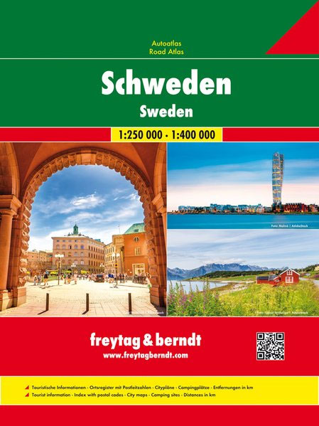
Sweden Road Atlas at 1:400,000 combining Freytag & Berndt’s regional road maps of the country into one 15 x 26cm, spiral-bound volume with seven street plans including Stockholm, Gothenburg and Malmรถ, an index with postal codes, plus mapping of Europe at 1:3,500,000.Road network includes what is often described on maps of Sweden as ‘private” roads: unsurfaced local roads open to the general public but simply privately maintained. Toll routes, restrictions and winter closures, steep gradients, motorway services, etc are shown and scenic roads and special tourist routes are highlighted. Railways with stations, ferry services, and local administrative boundaries are marked. National parks and prohibited areas are highlighted and symbols show places of interest, campsites, mountain shelters, youth hostels, etc. The maps have latitude and longitude lines at intervals of 30’. The index lists localities with their post codes. Multilingual map legend includes English.Also included are street plans of city centres in Stockholm, Gothenburg, Linkรถping, Malmรถ, Sundsvall, Umeรฅ and Uppsala. In common with many road atlases produced by Central European publishers, this atlas also includes an indexed section showing Europe at 1:3,500,000 for general route planning.

Related Products:
 Sweden Norstedts Large Road Atlas
 Sweden Norstedts Road Atlas 2021
 Sweden South – Malmo ‘“ Helsingsborg – Kalmar F&B
 Sweden South-West – Gothenburg ‘“ Vanersee – Karlstad F&B
 Sweden Southeast – Stockholm – Uppsala – Norrkoping F&B
 Sweden: Freytag & Berndt Regional Road Maps
 Sweden F&B
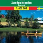 Sweden North – Ostersund F&B
 Sweden Marco Polo Map
 Sweden Central – Sundsvall ‘“ Falun – Gavle F&B
 Croatia – Slovenia F&B Road Atlas
 Sweden: Norstedts Regional Road Maps
Sweden ITMB Railway & Road Map
Germany Marco Polo Road Atlas 2021/2022
Sweden: Norstedts Regional Road Maps
Sweden ITMB Railway & Road Map
Germany Marco Polo Road Atlas 2021/2022
 Central Europe F&B Compact Road Atlas
 Sweden South Reise Know-How
 Norway F&B Supertouring Road Atlas SPIRAL-BOUND
 Europe Marco Polo Road Atlas
Sweden Norstedts Road Atlas
Europe Marco Polo Road Atlas
Sweden Norstedts Road Atlas
 Sweden Michelin
Germany Marco Polo Road Atlas 2020/2021
Sweden Michelin
Germany Marco Polo Road Atlas 2020/2021
 Belgium – Netherlands – Luxembourg Marco Polo Road Atlas
 Central Europe F&B Road Atlas
Italy F&B Great Road Atlas SPIRAL-BOUND
Central Europe F&B Road Atlas
Italy F&B Great Road Atlas SPIRAL-BOUND
 Europe Philip`s Big Road Atlas 2021 A3
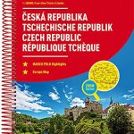 Czech Republic Marco Polo Road Atlas
 Europe F&B Compact Road Atlas
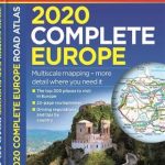 Europe Philip`s Complete Road Atlas 2020
 Alps – Northern Italy MairDumont Road Atlas SPIRAL-BOUND
 Austria F&B Road Atlas
 Finland Road Atlas GLOVEBOX, SPIRAL-BOUND
 Estonia Jana Seta Road Atlas
 Finland & Sweden ITMB
 Benelux – North France Michelin Road Atlas SPIRAL-BOUND
 South Africa Map Studio Road Atlas A4 PAPERBACK
 Austria – Liechtenstein – South Tyrol Marco Polo Road Atlas
 Spain – Portugal Marco Polo Road Atlas
Netherlands Falkplan Routiq Road Atlas
Spain – Portugal Marco Polo Road Atlas
Netherlands Falkplan Routiq Road Atlas
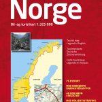 Norway Cappelens Road Atlas A4 SPIRAL-BOUND
 Bulgaria Road Atlas