Disclosure : This site contains affiliate links to products. We may receive a commission for purchases made through these links.
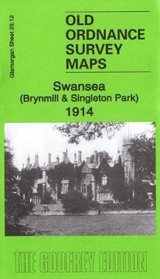
Swansea (Brynmill & Singleton Park) 1914 – 23.12
Related Products:
 Swansea Bay 1904 – 247
 Swansea (West) 1897 – 23.08
 Swansea (Landore) 1897 – 15.13
 Swansea 1897 – 24.05
 The Swansea Globe
 Swansea (North) 1897 – 24.01
 Swansea A-Z Pocket Street Map
 Gower, Swansea & Cardiff
 Admiralty Chart 1161 – Swansea Bay
 Admiralty Chart SC5608_7 – Swansea Bay
 Swansea, Gower & Carmarthen OS Landranger Map 159 (paper)
 Swansea – Neath & Port Talbot OS Explorer Map 165 (paper)
 Swansea, Gower & Carmarthen OS Landranger Active Map 159 (waterproof)
 Swansea – Neath & Port Talbot OS Explorer Active Map 165 (wateproof)
 Swansea – Bridgend – Carmarthen – Llanelli – Neath A-Z Street Atlas
 Wales Coast Path Official Guide 6: Carmarthen Bay & Gower: Tenby to Swansea
 Bavarian Forest National Park – Nature Park East UK50-29
 Maesteg 1914 – 26.09
 Nantyffyllon 1914 – 26.05
 Aberavon 1914 – 25.13
 Brimington 1914 – 18.15
 Murton 1914 – 21.06
 Darlington 1914 – 55.06b
 Wolverhampton SW 1914 – 62.10b
 Pleasley 1914 – 31.07
 Low Fell 1914 – 6.08b
 Penrhiwceiber & Tynetown 1914 – 19.10
 Staveley (North) 1914 – 18.12
 Staveley (South) 1914 – 18.16
 Whittington Moor 1914 – 18.14
 Halesowen (West) 1914 – 4.16b
 Gateshead Fell 1914 – 7.05b
 Stockton (North) 1914 – 50.12b
 Mansfield Woodhouse 1914 – 23.09
 Central Sunderland 1914 – 8.14b
 Tipton 1914: Staffordshire Sheet 67.08b
 Dudley 1914: Staffordshire Sheet 67.16c
 Round Oak 1914: Staffordshire Sheet 71.03b
 Wolverhampton (NW) 1914: Staffordshire Sheet 62.06b
 Stourbridge (North) & Amblecote 1914 – 4.10b


