Disclosure : This site contains affiliate links to products. We may receive a commission for purchases made through these links.
Svalbard Tourist Map

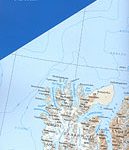
The Svalbard Archipelago: Spitsbergen, Nordaustlandet, Edgeoya and the smaller islands at 1:1,000,000 from the Norsk Polarinstitutt showing the topography, settlements, airfields, etc. The same map is available in two different versions: topographic edition and tourist version.The map itself is the same in both versions and presets the topography by contours at 200m intervals plus spot heights. The map shows settlements, roads, airfields, lighthouses, radio stations and beacons. Latitude lines are drawn at 1ยฐ intervals, with longitude at 3ยฐ but with margin ticks at 1ยฐ. Bjornoya is included on an inset.TOPOGRAPHIC VERSION: the map has a bilingual Norwegian/English legend and a glossary of topographic terms, and includes a small map indicating the extent of polar icecap in April and September, plus a grid showing the division of the archipelago into more detailed topographic coverage at 1:100,000.TOURIST VERSION (this map): there is no map legend or other information included on the topographic version. Instead the map is surrounded by photographs of various aspects of the archipelago.

Related Products:
 Svalbard Topographic Map
 Svalbard North-West
Svalbard South-West
Svalbard North-West
Svalbard South-West
 Norway: 500K Topographic Survey of Svalbard/Spitsbergen
Svalbard North
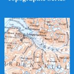
Norway: 250K Topographic Survey of Svalbard/Spitsbergen
Svalbard South-East
Norway: 500K Topographic Survey of Svalbard/Spitsbergen
Svalbard North
Norway: 250K Topographic Survey of Svalbard/Spitsbergen
Svalbard South-East
 Svalbard North-East
 Norway: 100K Topographic Survey of Svalbard/Spitsbergen
 Spitsbergen Explorer
 Lofoten Nordeca Tourist Route 20014
 Iceland Mal og menning Tourist Map
 Havoysund Nordeca Tourist Route 20017
 Sognefjellet Nordeca Tourist Route 20008
 Varanger Nordeca Tourist Route 20018
 Aeolian (Lipari) Islands Global Map Tourist Map
 Valdresflye Nordeca Tourist Route 20006
 Old Strynefjellsvegen Nordeca Tourist Route 20009
 Aurlandsfjellet Nordeca Tourist Route 20005
 Svalbard (Spitsbergen), Franz Josef Land and Jan Mayen Bradt Guide
 Hebron Tourist Map
 Dolomites Tabacco UNESCO Tourist Map
 Atlantic Road Nordeca Tourist Route 20012
 Luxembourg: 20K Topographic Tourist Maps
 Ryfylke Nordeca Tourist Route 20002
 Gaularfjellet Nordeca Tourist Route 20007
 Norway – Oslo to North Cape & Svalbard
 Gargano Global Map Tourist Map
 Iceland: Topographic Hiking and Tourist Maps
 Capri Global Map Tourist Map
 Greenland
 Costa Smeralda Global Map Tourist Map
 Helgeland Coast North Nordeca Tourist Route 20013
 Innsbruck F&B Tourist Street Plan
 Sorrento Peninsula – Amalfi Coast – Capri Global Map Tourist Map
 Bornholm Kompass 236
Zรผrich Tourist Map
Bornholm Kompass 236
Zรผrich Tourist Map
 Catalonia Tourist Road – Regional Divisions Map
 Lofoten – Vaeroy
 France: IGN 200K Tourist Maps