Disclosure : This site contains affiliate links to products. We may receive a commission for purchases made through these links.
Svalbard South-East
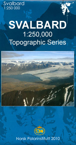
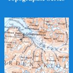
The south-eastern part of the Svalbard (Spitsbergen) group at 1:250,000 in a new series of five topographic maps first published by the Norsk Polarinstitutt in late 2010, with extensive index of geographical features, glossary, rules for visitors, etc. The map covers Barentsรธya and Edgeรธya, plus the islands further south including Hopen.Maps in this series provide an excellent representation of the topography, with contours at 100m intervals enhanced by relief shading and numerous spot heights, plus colouring and/or graphics for glaciers, moraine, braided rivers and flat foreshore. Boundaries of nature conservation areas are clearly marked.The map shows roads and tracks or paths, as well as airfields and heliports, power lines and aerials cableways, lighthouses and masts, working and disused mines, etc. Within the settled areas schools, churches and medical facilities are also indicated. The maps have UTM plus latitude (15’) and longitude (30’) grids. Extensive index of geographical features gives locations by latitude/longitude coordinates.On the reverse of each title are two small maps of the whole group showing magnetic declination and nature conservation areas. Another map shows the area of Spitsbergen around the Isfjorden where visitors can travel without a permit. Each map also includes a glossary of geographical terms and notes on Svalbard’s cultural heritage. Map legend and all the text include English.

Related Products:
 Svalbard South-West
 Svalbard North-East
Svalbard North
Svalbard North-West
Norway: 250K Topographic Survey of Svalbard/Spitsbergen
Svalbard North-East
Svalbard North
Svalbard North-West
Norway: 250K Topographic Survey of Svalbard/Spitsbergen
 Norway: 100K Topographic Survey of Svalbard/Spitsbergen
 Norway: 500K Topographic Survey of Svalbard/Spitsbergen
 Spitsbergen / Svalbard – Northern Norway ITMB
 Svalbard Topographic Map
 Svalbard Tourist Map
Spitsbergen South
Svalbard Tourist Map
Spitsbergen South
 South East England – Midlands – East Anglia Michelin Regional 504
 Spitsbergen Explorer
 South Westland: Aoraki/Mount Cook, Lake Tekapo, Twizel
 Otago – South Canterbury: Timaru, Oamaru, Wanaka, Alexandra
 Svalbard (Spitsbergen), Franz Josef Land and Jan Mayen Bradt Guide
 Iceland South-East IDNU 4
 East Cape: Whakatane, Opotiki, Gisbourne, Wairoa
 Sail to Svalbard
 Drenthe South-East
 South East Queensland Hema
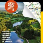 Estonia South-East Regio Map
 Caribbean Islands East & South ITMB Travel Atlas
 Switzerland South East Swisstopo 4
 South East Asia ITMB
 Vilnius South East and Its Environs
 South East Queensland – featuring Landcruiser Mountain Park Hema Explorer Map
 South-Holland South – Goeree-Overflakkee Falkplan Cycling Map 15
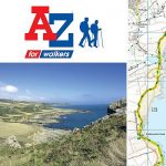
 South East Lewis – Loch Eireasort & Shiant Islands OS Explorer Map 457 (paper)
 Orkney: East Mainland – South Ronaldsay, Shapinsay & Kirkwall OS Explorer Map 461 (paper)
 South East Lewis – Loch Eireasort & Shiant Islands OS Explorer Active Map 457 (waterproof)
 South West Coast Path 4 – South Devon Adventure Atlas
 South Island – New Zealand Kiwimaps
 Florida & US Deep South ITMB
 South West Coast Path 3 – South Cornwall A-Z Adventure Atlas
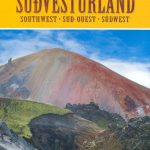
 South-East Styrian Hills – Vulkanland – Bad Gleichenberg – Bad Radkersburg F&B WK412
 China South Wall Map
North East New South Wales – Coffs Harbour to Brisbane Hema Explorer Map
China South Wall Map
North East New South Wales – Coffs Harbour to Brisbane Hema Explorer Map
 Orkney: East Mainland – South Ronaldsay, Shapinsay & Kirkwall OS Explorer Active Map 461 (waterproof)
 South Africa – Namibia – Botswana Hallwag Road Map