Disclosure : This site contains affiliate links to products. We may receive a commission for purchases made through these links.
Suva Mountains

Suva Mountains with the Gorges of the Jelaลกnicka River on a detailed contoured map at 1:55,000, plus extensive information on the tourist facilities in the area with colour photos of mountain shelters, notes on fauna and flora, etc. The map has contours at 20m intervals with relief shading and colouring for woodlands. Different levels of protection zones are marked and areas where hunting is allowed are indicated. An overprint highlights waymarked hiking trails including the 130km long-distance trail across the Niลก range. Also marked are different types of tourist accommodation including campsites and hunting lodges, paragliding sites, skiing areas, etc. The map has latitude and longitude lines at intervals of 5’. Map legend includes English.On the reverse are extensive bilingual notes on the area and its tourist facilities illustrated with numerous photos.

Related Products:
 Bled Pocket Map
 Rodnei Mountains Dimap Hiking Map
 Apuseni Mountains
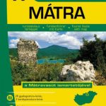 Matra Mountains Atlas
 Bรผkk Mountains Atlas
 Zemplรฉn Mountains Atlas
 Bรถrzsรถny Mountains Atlas
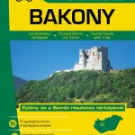 Bakony and Somlรณ Mountains Atlas
 Vlasina Lake
 Balaton Highlands & Keszthely Mountains Atlas
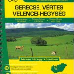 Gerecse – Vertes – Velence Mountains Atlas
 Radan and Sokolovica Mountains
 Valjevo Mountain Range
 Caliman Mountains Dimap Hiking Map
Gilau Mountains Dimap Hiking Map
Tarcau Mountains and Ghimes Dimap Hiking Map
Caliman Mountains Dimap Hiking Map
Gilau Mountains Dimap Hiking Map
Tarcau Mountains and Ghimes Dimap Hiking Map
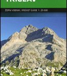 Triglav Pocket Map
 Giurgeu and Hasmas Mountains Dimap Hiking Map
 Tara National Park
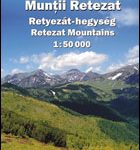
 Retezat Mountains Bel Alpin Tourist Map
 Melbourne to Sydney Hema
 Carpathian Mountains (AT/CZ/SK/PL/UA/HU/RO) Huber Map
 Paลกman Island Croatian Mountain Rescue Service 25K Map
 Retezat Mountains Dimap Hiking Map
Gurghiu Mountains Northern and Central Dimap Hiking Map
Retezat Mountains Dimap Hiking Map
Gurghiu Mountains Northern and Central Dimap Hiking Map
 Ugljan, Rivanj & Sestrunj Islands Croatian Mountain Rescue Service 25K Map
 Cindrel Mountains
 Gulf of Orosei
 Gulf of Oristano
 South Africa: 50K Hiking Maps of the Drakensberg Mountains
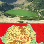
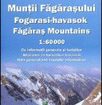 Fagaras Mountains Dimap Hiking Map
Santa Margherita to Calasetta
Bay of Porto Conte to Platamona
Capo San Lorenzo to Capitana
Fagaras Mountains Dimap Hiking Map
Santa Margherita to Calasetta
Bay of Porto Conte to Platamona
Capo San Lorenzo to Capitana
 Piatra Craiului – Bucegi – Postavarul – Piatra Mare – Ciucas Mountains Dimap Hiking Map
 Bihor Mountains Dimap Hiking Map
Cagliari and Golfo degli Angeli
Marina di Sorso to Costa Paradiso
Bihor Mountains Dimap Hiking Map
Cagliari and Golfo degli Angeli
Marina di Sorso to Costa Paradiso