Disclosure : This site contains affiliate links to products. We may receive a commission for purchases made through these links.
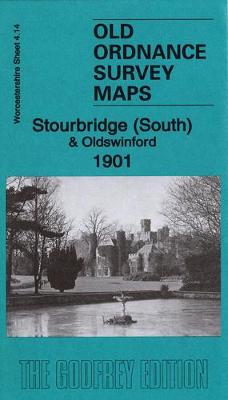
Stourbridge (South) & Oldwinsford: Worcestershire Sheet 4.14a
Related Products:
 Droitwich (South) 1902: Worcestershire Sheet 29.02
 Selly Oak & Bournville 1914: Worcestershire Sheet 10.04b
 Droitwich (North) 1901: Worcestershire Sheet 22.14
 Stourbridge South and Oldswinford 1914
 Castleford (South) 1905: Yorkshire Sheet 234.11
 Meltham (South) 1904: Yorkshire Sheet 260.13
 Morley (South) 1906: Yorkshire Sheet 232.08
 Bradford (South) 1905: Yorkshire Sheet 216.12
 South Shields 1913: Tyneside Sheet 9b
 Bridlington (South) 1909: Yorkshire Sheet 146.06
 York (South) 1889: Yorkshire Sheet 174.10a
 Langley Green & South Oldbury 1938: Staffordshire Sheet 72.02c
 Liversedge (Hightown) & South Cleckheaton 1905: Yorkshire Sheet 232.09
 Gateshead South (Bensham, Teams & Shipcote) 1914: Tyneside Sheet 23b
 Stourbridge (North) & Amblecote 1914 – 4.10b
 Admiralty Chart AUS133 – Plans in South Australia (Sheet 3)
 Admiralty Chart AUS135 – Plans in South Australia (Sheet 4)
 Admiralty Chart 3595 – South Georgia Central Sheet
 Admiralty Chart 3283 – Shetland Islands South Sheet
 Admiralty Chart 3582 – Harbour and Anchorages in South Georgia, Sheet 3
 Admiralty Chart 3586 – Harbours and Anchorages in South Georgia, Sheet 2
 Leadhills: Brief Sheet Explanation for 1: 50 000 Scale Geology Map, Sheet S15e (Scotland)
 Solid Geology Map United Kingdom, Ireland and Adjacent Continental Shelf – South Sheet
 Worcestershire
 Stourbridge (North) & Amblecote 1901 – 4.10a
 Wolverhampton & Dudley – Stourbridge & Kidderminster OS Explorer Map 219 (paper)
 Worcestershire Pevsner Architectural Guide
 Wolverhampton & Dudley – Stourbridge & Kidderminster OS Explorer Active Map 219 (waterproof)
 Herefordshire, Worcestershire & North Gloucestershire 110K Sustrans Cycle Map No. 15
 Pearson`s Canal Companion – Severn and Avon: Mid-Worcestershire Ring and Cotswold Canals
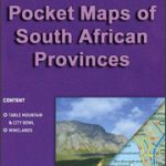 South Africa: Map Studio Pocket Maps of South African Provinces
 Admiralty Chart Folio 72 – New Zealand ‘“ South Island, South of Cook Strait incl. Macquaire and other off-lying islands
 Admiralty Chart Folio 96 – East Coast of South America – Punta Piedras to Puerto Gallegos incl. Falkland Islands, South Georgia
 Wildlife Awareness Manual: Antarctic Peninsula, South Shetland Islands, South Orkney Islands
 Admiralty Chart Folio 35 – Eastern South Atlantic Ocean, South Africa and Southern Ocean
 Dudley 1914: Staffordshire Sheet 67.16c
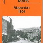 Ripponden 1904: Yorkshire Sheet 245.07
 Stechford 1902: Warwickshire Sheet 14.07
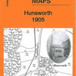 Hunsworth 1905: Yorkshire Sheet 232.01
 Moseley 1903: Warwickshire Sheet 14.13a


