Disclosure : This site contains affiliate links to products. We may receive a commission for purchases made through these links.
Stara Planina Central: Zlatitsa to Kalofer Domino Map
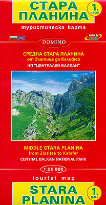
Stara Planina Central: Zlatitsa to Kalofer map at 1:50,000 from Bulgarian publishers Domino, contoured and GPS compatible, with hiking trails, accommodation options including a list of local mountain refuges, etc. The map is double-sided and covers the mountains from just west of Ribaritsa and Zlatitsa eastwards beyond Kalofer to the peak of Zli Vrah.Maps in the Domino series have contours (interval in most titles is 20m or 50m), enhanced by relief shading plus plenty of peak names and additional spot heights. Boundaries of national parks and other protected areas are marked. An overprint highlights both waymarked routes and unmaintained hiking trails. Although not specifically named on them, the maps can be used to follow local sections of the E3, E4 and E8 trans-European long-distance routes.Road network is graded according to width, indicates locations of petrol stations, and includes local country tracks and paths. Railway lines are shown with stations. Symbols mark locations of hotels and holiday homes, campsites, mountain refuges, shepherd’s huts and hunting lodges, as well as various places of interest and natural sites. Names of towns, villages and main topographic features are in both Cyrillic and Latin alphabet; smaller peaks or rivers and streams are in Cyrillic only. The maps have latitude and longitude grid at intervals of 5’. Map legend includes English. Most titles also include a list of local mountain refuges with contact details.To see other titles in this series please click on the series link.

Related Products:
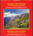 Stara Planina Western: Berkovita to Zlatitsa Domino Map
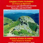 Stara Planina Central: Uzana to Vratnik Domino Map
 Bulgaria: Domino Hiking Maps
 Strandzha Mountains: Burgas to the Turkish Border Domino Map
 Sredna Gora
 Western Rhodope Mountains Domino Map
 Rila Mountains Domino
 Pirin Mountains Domino
 Stara Planina
 Sobrarbe Central – Ainsa – Boltana Editorial Alpina
 Stara Zagora
 Mallorca – Tramuntana Central Editorial Alpina
 Transrhodopi – Long distance hiking and biking trail From Trigrad to Ivaylovgrad
 Bulgaria Domino DOUBLE-SIDED Road Map
 Italy: IGA 25K Hiking Maps of Central Italy
 Italy: IGA 50K Hiking Maps of Central Italy
 Sardinia Central 4-Map Set Kompass 2498
 Frรคnkische Alb Central
 Central Salzkammergut – Ausseerland Kompass 020
 Harz Central Kompass 452
 Karwendelgebirge Central Alpenverein Map 5/2
 Verwallgruppe Central Alpenverein Map 28/2
 Totes Gebirge Central Alpenverein KOMBI Map 15/2
 Central Moselle Valley – Trier to Zell K+F Outdoor Map 22
 Stubai Alps Central Alpenverein Map 31/4
 Bavarian Forest Central Kompass 196
 Zillertal Alps Central – Mayrhofen Alpenverein Map 35/2
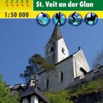 Central Carinthia – Gurktal Alps – Friesach – Feldkirchen – St. Veit an der Glan F&B WK231
 Central Macedonia Terrain Editions Regional Map 2
 Posets-Maladeta Natural Park 2-Map Set Editorial Alpina
 Central Pyrenees terraQuest Trekking Map
 Innsbruck – Nordkette – Central Inntal Kompass 036
 Upper Central Rhine – Koblenz to Bingen – Loreley – Rรผdesheim K+F Outdoor Map 32
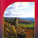 Peak District Central Harvey Superwalker XT25
 Central Rhodopes / Rodopi Geopsis 132
 Sant Llorenc del Munt i l`Obac Editorial Alpina
 Halle – Dessau-Rosslau – Central Elbe – Lower Saale Valley
 Peak District Central Harvey Ultramap XT40
 Picos de Europa – Central and East Massifs: Los Urrieles and Andara Adrados Map PAPER