Disclosure : This site contains affiliate links to products. We may receive a commission for purchases made through these links.
Stanfords Maps of London Boroughs (PRINT ON DEMAND/FLAT MAPS)

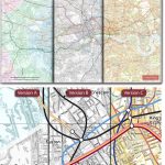
Stanfords Maps of London Boroughs (PRINT ON DEMAND/FLAT MAPS) are produced in-house by the digital department at our Long Acre store and have been designed by laying a bespoke, tailored borough map onto on a base map using Ordnance Survey Street View mapping. Each borough area is represented by a colour map, with the surrounding area of neighbouring boroughs shown in greyscale background. The size of paper used for printing is different for each borough, with one dimension (width or length) maximized to 91cm, and the other dimension governed by the shape of the borough.PLEASE NOTE* Map scales and dimensions depend on the size of the borough being printed; please see individual borough entries for both scale and dimension. * Printing smaller size borough maps is possible on consultation; the minimum scale recommended is no less than 1:11,000. * Borough maps are FLAT WALL MAPS and will be delivered rolled in a postal tube.

Related Products:
 London Boroughs Poster Map – Stanfords Print on Demand
 London: Greenwich Borough Map – Stanfords Print on Demand
London: Hillingdon Borough Map – Stanfords Print on Demand
London: Greenwich Borough Map – Stanfords Print on Demand
London: Hillingdon Borough Map – Stanfords Print on Demand
 London: Redbridge Borough Map – Stanfords Print on Demand
London: Bexley Borough Map – Stanfords Print on Demand
London: Hounslow Borough Map – Stanfords Print on Demand
London: Redbridge Borough Map – Stanfords Print on Demand
London: Bexley Borough Map – Stanfords Print on Demand
London: Hounslow Borough Map – Stanfords Print on Demand
 London: Lambeth Borough Map – Stanfords Print on Demand
London: Camden Borough Map – Stanfords Print on Demand
London: Lambeth Borough Map – Stanfords Print on Demand
London: Camden Borough Map – Stanfords Print on Demand
 London: Islington Borough Map – Stanfords Print on Demand
London: Southwark Borough Map – Stanfords Print on Demand
London: Westminster Borough Map – Stanfords Print on Demand
London: Hackney Borough Map – Stanfords Print on Demand
London: Wandsworth Borough Map – Stanfords Print on Demand
London: Islington Borough Map – Stanfords Print on Demand
London: Southwark Borough Map – Stanfords Print on Demand
London: Westminster Borough Map – Stanfords Print on Demand
London: Hackney Borough Map – Stanfords Print on Demand
London: Wandsworth Borough Map – Stanfords Print on Demand
 London: Newham Borough Map – Stanfords Print on Demand
 London: Haringey Borough Map – Stanfords Print on Demand
London: Merton Borough Map – Stanfords Print on Demand
London: Ealing Borough Map – Stanfords Print on Demand
London: Lewisham Borough Map – Stanfords Print on Demand
London: Sutton Borough Map – Stanfords Print on Demand
London: City of London Borough Map – Stanfords Print on Demand
London: Haringey Borough Map – Stanfords Print on Demand
London: Merton Borough Map – Stanfords Print on Demand
London: Ealing Borough Map – Stanfords Print on Demand
London: Lewisham Borough Map – Stanfords Print on Demand
London: Sutton Borough Map – Stanfords Print on Demand
London: City of London Borough Map – Stanfords Print on Demand
 London: Richmond upon Thames Borough Map – Stanfords Print on Demand
London: Kensington and Chelsea Borough Map – Stanfords Print on Demand
London: Tower Hamlets Borough Map – Stanfords Print on Demand
London: Hammersmith and Fulham Borough Map – Stanfords Print on Demand
London: Bromley (Northern Sheet) Borough Map – Stanfords Print on Demand
London: Bromley (Southern Sheet) Borough Map – Stanfords Print on Demand
London: Havering (Northern Sheet) Borough Map – Stanfords Print on Demand
London: Havering (Southern Sheet) Borough Map – Stanfords Print on Demand
London: Barnet (Southern Sheet) Borough Map – Stanfords Print on Demand
London: Barnet (Northern Sheet) Borough Map – Stanfords Print on Demand
London: Richmond upon Thames Borough Map – Stanfords Print on Demand
London: Kensington and Chelsea Borough Map – Stanfords Print on Demand
London: Tower Hamlets Borough Map – Stanfords Print on Demand
London: Hammersmith and Fulham Borough Map – Stanfords Print on Demand
London: Bromley (Northern Sheet) Borough Map – Stanfords Print on Demand
London: Bromley (Southern Sheet) Borough Map – Stanfords Print on Demand
London: Havering (Northern Sheet) Borough Map – Stanfords Print on Demand
London: Havering (Southern Sheet) Borough Map – Stanfords Print on Demand
London: Barnet (Southern Sheet) Borough Map – Stanfords Print on Demand
London: Barnet (Northern Sheet) Borough Map – Stanfords Print on Demand
 Stanfords Tube Maps (PRINT ON DEMAND/FLAT MAPS)
 London Boroughs at 50
 London: A-Z Wall Maps of London in 1964
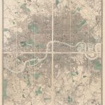
 Stanford`s New Two Inch Map of London (1913) – A2 Wall Map, Canvas – Print on Demand
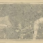 Stanford`s Library Map of London Sheet 10 Black and White (1862) – A3 Wall Map, Paper – Print on Demand
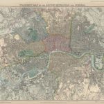 Stanford`s Map of the British Metropolis: London (1877) – A1 Wall Map, Paper – Print on Demand
 Stanford`s Library Map of London and its Suburbs (1878) – A1 Wall Map, Paper – Print on Demand
 Stanford`s Western Hemisphere Map (1877) – A1 Wall Map, Paper – Print on Demand
 Stanford`s Map of the County of London (1888) – A1 Wall Map, Paper – Print on Demand
 Enfield – Barnet London Boroughs