Disclosure : This site contains affiliate links to products. We may receive a commission for purchases made through these links.
Stanford`s Library Map of London and its Suburbs (1878) – A1 Wall Map, Paper – Print on Demand

Print on Demand map from the Edward Stanford Cartographic Collection archive.The Stanford’s Library Map of London and its Suburbs is from a fascinating series of reproductions from our Edward Stanford Cartographic Collection archive.
Related Products:
 Stanford`s Library Map of London and its Suburbs (1878) – A3 Wall Map, Paper
 Stanford`s Library Map of London and its Suburbs (1878) – A2 Wall Map, Paper
 Stanford`s Library Map of London and its Suburbs (1878) – A3 Wall Map, Canvas
 Stanford`s Library Map of London and its Suburbs (1878) – A2 Wall Map, Canvas
 Stanford`s Library Map of London and its Suburbs (1878) – A1 Wall Map, Canvas
 Stanford`s Library Map of Japan (1879) – A1 Wall Map, Paper – Print on Demand
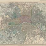 Stanford`s Map of the British Metropolis: London (1877) – A1 Wall Map, Paper – Print on Demand
 Stanford`s Library Map of London Sheet 10 Black and White (1862) – A3 Wall Map, Paper – Print on Demand
 Stanford`s New Library Chart of the World (1920) – A3 Wall Map, Paper – Print on Demand
 Stanford`s New Library Chart of the World (1920) – A2 Wall Map, Paper – Print on Demand
 Stanford`s New Two Inch Map of London (1913) – A2 Wall Map, Canvas – Print on Demand
 Stanford`s New Library Chart of the World (1920) – Original Size Wall Map, Paper – Print on Demand
 Stanford`s Route Map of the Earth Colour (1854) – A1 Wall Map, Paper – Print on Demand
 Stanford`s New Library Chart of the World (1920) – Original Size Wall Map, Canvas – Print on Demand
 Stanford`s Facsimile of the Hereford Mappa Mundi (1869) – A3 Wall Map, Paper – Print on Demand
 Stanford`s Facsimile of the Hereford Mappa Mundi (1869) – A1 Wall Map, Paper – Print on Demand
 Stanford`s Folio Smaller Railway Map of the United States (1876) – A3 Wall Map, Paper – Print on Demand
 Stanford`s Folio Smaller Railway Map of the United States (1876) – A2 Wall Map, Paper – Print on Demand
 Stanford`s Varty`s Roman Empire Map (1879) – A4 Wall Map, Paper – Print on Demand
 Stanford`s Varty`s Roman Empire Map (1879) – A1 Wall Map, Paper – Print on Demand
 Stanford`s Map of the County of London (1888) – A1 Wall Map, Paper – Print on Demand
 Stanford`s New Map of Kabul (1880) – A1 Wall Map, Paper – Print on Demand
 Stanford`s Library Map of South America (1864) – A2 Wall Map, Canvas – Print on Demand
 Stanford`s Map of the Siberian Railway (1904) – A2 Wall Map, Paper – Print on Demand
 Stanford`s Map of the Siberian Railway (1904) – A3 Wall Map, Paper – Print on Demand
 Stanford`s Map of the Siberian Railway (1904) – A1 Wall Map, Paper – Print on Demand
 Stanford`s South Polar Chart (1901) – A1 Wall Map, Paper – Print on Demand
 Stanford`s Library Map of London Sheet 21 Colour (1862) – A1 Wall Map, Paper
 Stanford`s Folio Smaller Railway Map of the United States (1876) – A2 Wall Map, Canvas – Print on Demand
 Stanford`s Library Map of London Sheet 5 Black and White (1862) – A3 Wall Map, Paper
 Stanford`s Library Map of London Sheet 6 Black and White (1862) – A3 Wall Map, Paper
 Stanford`s Library Map of London Sheet 7 Black and White (1862) – A3 Wall Map, Paper
 Stanford`s Library Map of London Sheet 9 Black and White (1862) – A3 Wall Map, Paper
 Stanford`s Library Map of London Sheet 13 Black and White (1862) – A3 Wall Map, Paper
 Stanford`s Library Map of London Sheet 14 Black and White (1862) – A3 Wall Map, Paper
 Stanford`s Library Map of London Sheet 15 Black and White (1862) – A3 Wall Map, Paper
 Stanford`s Map of the Siberian Railway (1904) – Original Size Wall Map, Paper – Print on Demand
 Stanford`s Folio British Isles Map (1884) – A2 Wall Map, Paper – Print on Demand
 Stanford`s General Map of the World (1920) – A1 Wall Map, Paper – Print on Demand
 Stanford`s Folio British Isles Map (1884) – A1 Wall Map, Paper – Special Edition – Print on Demand


