Disclosure : This site contains affiliate links to products. We may receive a commission for purchases made through these links.
Stanfords General Map of the World (1920) 60×80 Art Print

The Art Prints are produced on 230gsm matt-coated art paper. They are supplied rolled.
Related Products:
 Stanfords Map of the County of London (1888) 60×80 Art Print
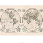
 Stanfords Eastern and Western Hemispheres Map (1887) 60x80cm Art Print
 Stanfords Sepia General Map of the World (1920) 60×80 Canvas Print
 Stanfords Colour General Map of the World (1920) 60×80 Canvas Print
 Stanfords New Library Chart of the World (1920) 60×80 Canvas Print
 Stanford`s General Map of the World (1920) – A1 Wall Map, Paper – Print on Demand
 Stanfords Pacific-Centred World Map (1884) 60×80 Canvas Print
 Stanfords Tourist Map of Europe (1928) 40×50 Canvas Print
 Stanfords Library Map of Japan (1879) 60×80 Canvas Print
 Stanfords Folio Europe Map (1884) 60×80 Canvas Print
 Stanfords Map of the County of London (1888) 60×80 Canvas Print
 Stanfords Folio Asia Map (1884) 60×80 Canvas Print
 Stanfords Library Map of London (1862) 40×50 Canvas Print
 Stanfords Eastern and Western Hemispheres Map (1887) 60x80cm Canvas Print
 Stanfords Folio British Isles Map (1884) 60×80 Canvas Print
 Stanfords Vartys Roman Empire Map (1879) 60x80cm Canvas Print
 Stanfords Folio North America Map (1884) 60×80 Canvas Print
 Stanford`s General Map of the World (1920) – A3 Wall Map, Paper
 Stanford`s General Map of the World (1920) – A2 Wall Map, Paper
 Stanford`s General Map of the World (1920) – XL Size (120 x 80cm) Wall Map, Paper
 Stanford`s New Library Chart of the World (1920) – A3 Wall Map, Paper – Print on Demand
 Stanford`s New Library Chart of the World (1920) – A2 Wall Map, Paper – Print on Demand
 Stanford`s New Library Chart of the World (1920) – Original Size Wall Map, Paper – Print on Demand
 Stanford`s General Map of the World (1920) – A3 Wall Map, Canvas
 Stanford`s General Map of the World (1920) – A2 Wall Map, Canvas
 Stanford`s General Map of the World (1920) – A1 Wall Map, Canvas
 Stanford`s General Map of the World (1920) – XL Size (120 x 80cm) Wall Map, Canvas
 Stanford`s New Library Chart of the World (1920) – Original Size Wall Map, Canvas – Print on Demand
 Stanfords General Map of the World Shoe Polish Set
 Stanfords General Map of the World Gent`s Grooming Kit
 Stanfords General Map of the World Glasses Case
 Stanfords General Map of the World (Colour) Maxi Poster
 Stanfords General Map of the World Playing Card Games Set
 Stanfords General Map of the World 100 Piece Cube Jigsaw Puzzle
 London Boroughs Poster Map – Stanfords Print on Demand
 Stanfords Maps of London Boroughs (PRINT ON DEMAND/FLAT MAPS)
 London: Greenwich Borough Map – Stanfords Print on Demand
 London: Hillingdon Borough Map – Stanfords Print on Demand
 London: Redbridge Borough Map – Stanfords Print on Demand
 London: Bexley Borough Map – Stanfords Print on Demand


