Disclosure : This site contains affiliate links to products. We may receive a commission for purchases made through these links.
Stanford`s Chart of the Solent, Spithead and Southampton Water (1932) – A2 Wall Map, Paper – Print on Demand
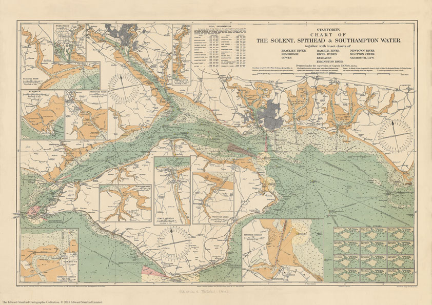
Print on Demand map from the Edward Stanford Cartographic Collection archive.The Stanford’s Chart of The Solent, Spithead and Southampton Water is from a fascinating series of reproductions from our Edward Stanford Cartographic Collection archive.Published in 1932, prepared under the supervision of Captain O.M.Watts, A.I.N.A. This map shows the entire Isle of Wight and the surrounding coast line from Selsey to Milford on Sea with inset charts of Beaulieu River, Bembridge, Cowes, Hamble River, River Itchen, Keyhaven, Lymington River, Newtown River, Wootton Creek and Yarmouth.This chart contains lots of tidal information and explanations. Soundings are given at low water ordinary spring tides in fathoms upon the general chart, and in feet upon the inserts.Based upon British Admiralty Charts with the permission of the controller of H.M. Stationary Office and of the Hydrographer of the Navy. This beautifully detailed map will be appeal to anyone with nautical interests.This is the A2 paper version.

Related Products:
 Stanford`s Chart of the Solent, Spithead and Southampton Water (1932) – A3 Wall Map, Paper – Print on Demand
Stanford`s Chart of the Solent, Spithead and Southampton Water (1932) – A1 Wall Map, Paper – Print on Demand
Stanford`s Chart of the Solent, Spithead and Southampton Water (1932) – Original Size Wall Map, Paper – Print on Demand
Stanford`s Chart of the Solent, Spithead and Southampton Water (1932) – A3 Wall Map, Canvas – Print on Demand
Stanford`s Chart of the Solent, Spithead and Southampton Water (1932) – A1 Wall Map, Canvas
Stanford`s Chart of the Solent, Spithead and Southampton Water (1932) – A2 Wall Map, Canvas
Stanford`s Chart of the Solent, Spithead and Southampton Water (1932) – Original Size Wall Map, Canvas
Stanford`s Chart of the Solent, Spithead and Southampton Water (1932) – A3 Wall Map, Paper – Print on Demand
Stanford`s Chart of the Solent, Spithead and Southampton Water (1932) – A1 Wall Map, Paper – Print on Demand
Stanford`s Chart of the Solent, Spithead and Southampton Water (1932) – Original Size Wall Map, Paper – Print on Demand
Stanford`s Chart of the Solent, Spithead and Southampton Water (1932) – A3 Wall Map, Canvas – Print on Demand
Stanford`s Chart of the Solent, Spithead and Southampton Water (1932) – A1 Wall Map, Canvas
Stanford`s Chart of the Solent, Spithead and Southampton Water (1932) – A2 Wall Map, Canvas
Stanford`s Chart of the Solent, Spithead and Southampton Water (1932) – Original Size Wall Map, Canvas
 Stanford`s South Polar Chart (1901) – A1 Wall Map, Paper – Print on Demand
 Stanford`s Library Map of Japan (1879) – A1 Wall Map, Paper – Print on Demand
 Stanford`s New Library Chart of the World (1920) – A3 Wall Map, Paper – Print on Demand
Stanford`s New Library Chart of the World (1920) – A2 Wall Map, Paper – Print on Demand
Stanford`s New Library Chart of the World (1920) – A3 Wall Map, Paper – Print on Demand
Stanford`s New Library Chart of the World (1920) – A2 Wall Map, Paper – Print on Demand
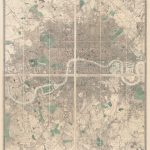
 Stanford`s Map of the British Metropolis: London (1877) – A1 Wall Map, Paper – Print on Demand
 Stanford`s Route Map of the Earth Colour (1854) – A1 Wall Map, Paper – Print on Demand
 Stanford`s Library Map of London and its Suburbs (1878) – A1 Wall Map, Paper – Print on Demand
Stanford`s New Library Chart of the World (1920) – Original Size Wall Map, Paper – Print on Demand
Stanford`s Library Map of London and its Suburbs (1878) – A1 Wall Map, Paper – Print on Demand
Stanford`s New Library Chart of the World (1920) – Original Size Wall Map, Paper – Print on Demand
 Stanford`s Facsimile of the Hereford Mappa Mundi (1869) – A3 Wall Map, Paper – Print on Demand
Stanford`s Facsimile of the Hereford Mappa Mundi (1869) – A1 Wall Map, Paper – Print on Demand
Stanford`s Facsimile of the Hereford Mappa Mundi (1869) – A3 Wall Map, Paper – Print on Demand
Stanford`s Facsimile of the Hereford Mappa Mundi (1869) – A1 Wall Map, Paper – Print on Demand
 Stanford`s New Map of Kabul (1880) – A1 Wall Map, Paper – Print on Demand
 Stanford`s Folio Smaller Railway Map of the United States (1876) – A3 Wall Map, Paper – Print on Demand
 Stanford`s Varty`s Roman Empire Map (1879) – A4 Wall Map, Paper – Print on Demand
Stanford`s Varty`s Roman Empire Map (1879) – A1 Wall Map, Paper – Print on Demand
Stanford`s Folio Smaller Railway Map of the United States (1876) – A2 Wall Map, Paper – Print on Demand
Stanford`s Varty`s Roman Empire Map (1879) – A4 Wall Map, Paper – Print on Demand
Stanford`s Varty`s Roman Empire Map (1879) – A1 Wall Map, Paper – Print on Demand
Stanford`s Folio Smaller Railway Map of the United States (1876) – A2 Wall Map, Paper – Print on Demand
 Stanford`s General Map of the World (1920) – A1 Wall Map, Paper – Print on Demand
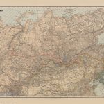 Stanford`s Map of the Siberian Railway (1904) – A2 Wall Map, Paper – Print on Demand
Stanford`s Map of the Siberian Railway (1904) – A3 Wall Map, Paper – Print on Demand
Stanford`s Map of the Siberian Railway (1904) – A1 Wall Map, Paper – Print on Demand
Stanford`s Map of the Siberian Railway (1904) – A2 Wall Map, Paper – Print on Demand
Stanford`s Map of the Siberian Railway (1904) – A3 Wall Map, Paper – Print on Demand
Stanford`s Map of the Siberian Railway (1904) – A1 Wall Map, Paper – Print on Demand
 Stanford`s New Two Inch Map of London (1913) – A2 Wall Map, Canvas – Print on Demand
 Stanford`s New Library Chart of the World (1920) – Original Size Wall Map, Canvas – Print on Demand
Stanford`s Map of the Siberian Railway (1904) – Original Size Wall Map, Paper – Print on Demand
Stanford`s Folio Smaller Railway Map of the United States (1876) – A2 Wall Map, Canvas – Print on Demand
Stanford`s New Library Chart of the World (1920) – Original Size Wall Map, Canvas – Print on Demand
Stanford`s Map of the Siberian Railway (1904) – Original Size Wall Map, Paper – Print on Demand
Stanford`s Folio Smaller Railway Map of the United States (1876) – A2 Wall Map, Canvas – Print on Demand
 Stanford`s Map of the County of London (1888) – A1 Wall Map, Paper – Print on Demand
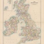
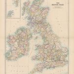 Stanford`s Folio British Isles Map (1884) – A2 Wall Map, Paper – Print on Demand
 Stanford`s Western Hemisphere Map (1877) – A1 Wall Map, Paper – Print on Demand
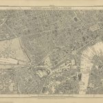 Stanford`s Library Map of London Sheet 10 Black and White (1862) – A3 Wall Map, Paper – Print on Demand
Stanford`s Map of the Siberian Railway (1904) – A1 Wall Map, Canvas – Print on Demand
Stanford`s Map of the Siberian Railway (1904) – A3 Wall Map, Canvas – Print on Demand
Stanford`s Library Map of London Sheet 10 Black and White (1862) – A3 Wall Map, Paper – Print on Demand
Stanford`s Map of the Siberian Railway (1904) – A1 Wall Map, Canvas – Print on Demand
Stanford`s Map of the Siberian Railway (1904) – A3 Wall Map, Canvas – Print on Demand
 Stanford`s Folio British Isles Map (1884) – A1 Wall Map, Paper – Special Edition – Print on Demand
 Stanford`s Eastern Hemisphere Map (1877) – A1 Wall Map, Paper – Print on Demand
 Stanford`s Africa Map (1879) – A2 Wall Map, Paper – Print on Demand
 Stanford`s Library Map of South America (1864) – A2 Wall Map, Canvas – Print on Demand