Disclosure : This site contains affiliate links to products. We may receive a commission for purchases made through these links.
St Anna Lake Dimap Hiking Map
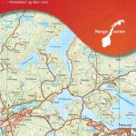
St Anna Lake at 1:35,000 in a series of detailed contoured maps covering popular hiking areas of Transylvania published by Dimap, one of Hungary’s leading publishers specializing in mapping of that region. The maps show local hiking routes and provide tourist information such as campsites, places of interest, etc. Many titles include street plans and/or English language descriptions of recommended hiking trails.*In this title:* hiking map with contours at 50m intervals, highlighting several local footpaths and trails with their waymarking signs. Symbols mark various types of accommodation, springs, caves, rock faces, places of interest, petrol stations, etc. The map is centred on Lake St Anna and the nearby Ciomat and Puturosu mountain ranges. Small insets show the towns of Baile Tusnad and Baile Balvanyos at enlarged scales, plus an overview map of the region. The map has no geographical coordinates. Notes on the reverse describe the region and list the tourist routes identified on the map.*Map legend and all the notes include English.*

Related Products:
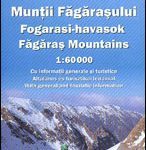 Fagaras Mountains Dimap Hiking Map
 Gilau Mountains Dimap Hiking Map
 Parang Mountains Dimap Hiking Map
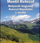 Retezat Mountains Dimap Hiking Map
 Bihor Mountains Dimap Hiking Map
Tarcau Mountains and Ghimes Dimap Hiking Map
Bihor Mountains Dimap Hiking Map
Tarcau Mountains and Ghimes Dimap Hiking Map
 Padis Dimap Hiking Map
 Giurgeu and Hasmas Mountains Dimap Hiking Map
Caliman Mountains Dimap Hiking Map
Gurghiu Mountains Northern and Central Dimap Hiking Map
Rarau-Giumalau Mountains and Bucovina Monasteries Dimap Hiking Map
Romania: Dimap Hiking Maps
Giurgeu and Hasmas Mountains Dimap Hiking Map
Caliman Mountains Dimap Hiking Map
Gurghiu Mountains Northern and Central Dimap Hiking Map
Rarau-Giumalau Mountains and Bucovina Monasteries Dimap Hiking Map
Romania: Dimap Hiking Maps
 Rodnei Mountains Dimap Hiking Map
 Piatra Craiului – Bucegi – Postavarul – Piatra Mare – Ciucas Mountains Dimap Hiking Map
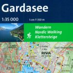 Lake Garda: Trento – Brescia – Verona 35K Kompass Hiking Atlas No. 2752
Red Lake Dimap Hiking Map
Lake Garda: Trento – Brescia – Verona 35K Kompass Hiking Atlas No. 2752
Red Lake Dimap Hiking Map
 Lake Balaton Cartographia Tourist Map 4
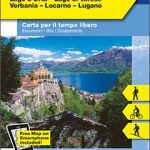 Lake Maggiore – Lake Orta – Lake Varese K+F Outdoor Map 8
 Lake Balaton Cycling Atlas
 Lake Constance West
Lake Constance East
Lake Constance West
Lake Constance East
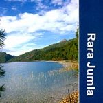 Dunai to Jumla and Rara Lake
 Lake Como – Lake Lugano Kompass 91
 Lake Constance K+F Hiking Map 2
 Lake Zurich – Lake Zug K+F Hiking Map 13
 The Fifth Lake (El Cinque Llac) Hiking Circuit
 Lake Maggiore – Lake Varese Kompass 90
 Lake Balaton Cartographia Leisure Map
 Lake Balaton II West Cartographia Water Sports & Cycling Map
Lake Garda – Lake Idro – Monte Baldo – Verona K+F Outdoor Map 7
Lake Balaton II West Cartographia Water Sports & Cycling Map
Lake Garda – Lake Idro – Monte Baldo – Verona K+F Outdoor Map 7
 Hegau – Western Lake Constance Kompass 783
 Ticino South – Lugano – Lake Maggiore K+F Hiking Map 29
 Franconian Lake District Kompass 174
 Lake Lucerne – Engelberg – Lucerne – Schwyz K+F Hiking Map 11
 Tilicho Hidden Lake
 Banff – Egypt Lake Gem Trek
Mecklenburg Lake District 3-Map Set Kompass 865
Banff – Egypt Lake Gem Trek
Mecklenburg Lake District 3-Map Set Kompass 865
 Lake Garda South – Bardolino – Lazise – Desenzano del Garda Kompass 695
 Lake Garda – Monte Baldo Kompass 102
 Lake Garda F&B WKI01