Disclosure : This site contains affiliate links to products. We may receive a commission for purchases made through these links.
Categories
-
Best Sellers
-

Admiralty Chart SC5608_10 – Scarweather Sands to North Kenfig Patches
NEWAdmiralty Small Craft nautical charts comply with Safety of Life at Sea (SOLAS) regulations and are ideal for professional, commercial and recreational use. Charts within the Read More » -

Miracle Brew: Hops, Barley, Water, Yeast and the Nature of Beer
Shortlisted for the 2017 Andre Simon Food and Drink Book AwardsBeer is the most popular alcoholic drink on the planet, but few who enjoy it know Read More » -

Chasing the Phantom: In Pursuit of Myth and Meaning in the Realm of the Snow Leopard
Eduard Fischer takes us on an exploration of myth, art, science, and the sacred space of high mountains. This is an account of adventure and deep Read More » -

The Munro Almanac
A slim sturdy hardbacked book, essential packing for all Scottish mountain walkers. Ascent details, map references and simple location diagrams for all 284 Munros are arranged Read More » -

Madagascar ITMB
Madagascar at 1: 1,000,000 on an indexed, double-sided map from ITMB with a large, clear street plan of central Antananarivo. The maps divides the island north/south Read More » -

Romsey, Andover & Test Valley – Stockbridge & Ludgershall OS Explorer Map 131 (paper)
Romsey, Andover, Test Valley, Stockbridge and Ludgershall area on a detailed topographic and GPS compatible map No. 131, paper version, from the Ordnance Survey’s 1:25,000 Explorer Read More » -

Lot – Tarn-et-Garonne Michelin Local 337
Lot and Tarn-et-Garonne dรฉpartments of France at 1:150,000 in Michelin’s Local Series, with highlighting for scenic routes, an index, a special panel with best sights and Read More » -

Torre de Moncorvo
Topographic survey of Portugal at 1:50,000 from the Instituto Geogrรกfico do Exรฉrcito, the country’s military survey organisation. The maps have contours at 20m intervals and in Read More » -

Chiltern Hills West – Henley-on-Thames & Wallingford OS Explorer Map 171 (paper)
Chiltern Hills West: Henley-on-Thames and Wallingford area on a detailed topographic and GPS compatible map No. 171, paper version, from the Ordnance Survey’s 1:25,000 Explorer series.MOBILE Read More » -

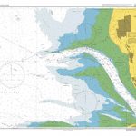
Admiralty Chart 1951 – Approaches to Liverpool
NEW EDITION OUT ON 18/02/2021Admiralty standard nautical charts comply with Safety of Life at Sea (SOLAS) regulations and are ideal for professional, commercial and recreational use. Read More »
-


