Disclosure : This site contains affiliate links to products. We may receive a commission for purchases made through these links.
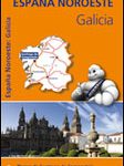
Spanish Atlantic Coast – Galicia – Asturias – Cantabria

North-western Spain and northern Portugal at 1:300,000 on large, double-sided map from MairDumont, plus street plans of central A Coruรฑa, Braga and Porto. A special feature of the ‘Marco Polo” maps and atlases is a set of seven peel-on/peel-off stickers which can be placed on the maps to help with navigating and removed without damaging the surface. The map, with an overlap between its sides, divides the region west/east, extending from the Atlantic Coast to Bilbao and south within Spain to Madrid and in Portugal to include most of the Serra da Estrela Natural Park. Topography is shown by relief shading with plenty of names of mountain ranges, etc. National parks and other protected areas are highlighted. Road network emphasizes main and secondary routes, both shown with driving distances, but also includes local road and selected tracks. Scenic roads are highlighted. Places of interest, including landscape features, are prominently highlighted. The map has no geographical coordinates. The index is in a separate booklet attached to the map cover. Also provided are street plans of central A Coruรฑa, Braga and Porto. Map legend includes English.To see the other titles in this series please click on the series link.

Related Products:
 Asturias – Cantabria Michelin Regional 572
 Galicia Michelin Regional 571
 Spain: Mairdumont 300K Regional Road Maps
 R Roca Verde: Sport climbing in north-west Spain: Asturias, Cantabria & Leon / Escalada Deportiva en la Cordillera Cantabrica: Asturias, Cantabria & Leon
 Portugal F&B
 Pyrenees – Costa Brava – Basque Country – Navarra – Aragon – Andorra – Catalonia
 Northern Portugal Turinta
 Spain – Portugal F&B
 Portugal North Michelin Regional 591
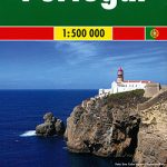
 Portugal Marco Polo Map
 Canary Islands
 Coast Around Lisbon Turinta
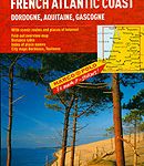 French Atlantic Coast – Dordogne – Aquitaine Gascogne Marco Polo Map
Central Portugal Turinta
French Atlantic Coast – Dordogne – Aquitaine Gascogne Marco Polo Map
Central Portugal Turinta
 Spain – Portugal Marco Polo Map
 Dalmatia – Croatia Coast Central and South
 Cantabria Autonomous Community CNIG Physical Road Map
 Croatia – Montenegro Coast Cartographia 2-Map Set
 Cantabria Province 200K CNIG Map No. 13
 Portugal Central Michelin Regional 592
 Asturias Province 200K CNIG Map No. 5
 Spain – Portugal Adventure Map
 Galicia: Santiago de Compostela – Leรณn 500K CNIG Regional Map No.1
 Ukraine – Moldova F&B
 Carinthia – Northern Adriatic Coast F&B
 The Way of St. James to Compostela: Spanish Section
 Croatian Coast K+F Road Map
 Picos de Europa and Eastern Coast of Asturias Adrados Map
 Czech Republic Marco Polo Road Atlas
 Java – Jakarta Nelles
 Spain: Michelin Zoom Espaรฑa Road Maps
 Belgium – Netherlands – Luxembourg Marco Polo Road Atlas
 Philadelphia & Mid-Atlantic States ITMB
 Portugal – Madeira Michelin
 Spain & Portugal AA Road Map
 Dalmatian Coast F&B Top 10 Tips
 Bulgarian and Romanian Coast
 Lisbon Borch