Disclosure : This site contains affiliate links to products. We may receive a commission for purchases made through these links.
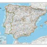
Spain CNIG Administrative Wall Map
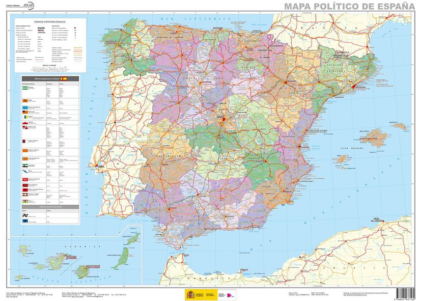
Administrative provinces of Spain shown in bright colours on a wall map at 1:2,250,000, size 70 x 50cm (27.5″ x 20″ approx), from IGN/CNIG – the country’s civilian survey organization, plus a panel of regional flags. Each province is presented in a different colour and the map also shows boundaries and names of administrative regions. Town symbols and names indicate their size and administrative status. The map shows the network of main roads and railways. Latitude and longitude lines are drawn at intervals of 1ยฐ. Map legend is in Spanish only.Next to the map is a panel listing Spain’s autonomous regions, including Ceuta and Melilla, each with its flag, plus a list of its constituent provinces and their capitals.

Related Products:
 Spain CNIG Physical Wall Map
Spain Autonomous Regions CNIG Wall Map
Spain CNIG Physical Wall Map
Spain Autonomous Regions CNIG Wall Map
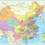
 China Administrative Wall Map
 Spain: CNIG Road Maps of Autonomous Administrative Regions
 The People`s Republic of China Administrative Map
 China Gizi Map Administrative Wall Map
 Spain and Portugal NGS Classic Wall Map PAPER
 Spain: CNIG 500K Regional Road Maps
 China Administrative Gizi Map
 Spain and Portugal 1842 SMALL
 Spain and Portugal 1885 SMALL
 Spain North 500K CNIG 2
New Zealand Wall Map
Spain North 500K CNIG 2
New Zealand Wall Map
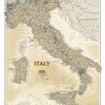
 Italy NGS Classic Wall Map PAPER
 Spain and Portugal NGS Classic Wall Map ENCAPSULATED
 Spain and Portugal NGS Executive Wall Map ENCAPSULATED
 Italy NGS Executive Wall Map PAPER
 Northern Spain NGS Adventure Map 3306
 Spain – Portugal F&B
 Spain: CNIG 200K Provincial Road Maps
 China Gizi Map Geographical Wall Map
 Spain – Portugal Adventure Map
 South East Asia Global Mapping Political Wall Map PAPER
 Germany Administrative F&B Wall Map
 Iran Wall Map
 South America Global Mapping Political Wall Map PAPER
 Spain and Portugal De Long Wine Wall Map
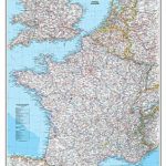 France, Belgium and Netherlands NGS Classic Wall Map PAPER
 Portugal & South of Spain ITMB
 Ukraine: Kartografija`s 250K Maps of the Administrative Regions
Kiev Administrative Region
Zaporizhzhia Administrative Region
Khmelnytskyi Administrative Region
Lviv Administrative Region
Mikolayiv Administrative Region
Rivne Administrative Region
Vinnytsia Administrative Region
Poltava Administrative Region
Kirovohrad Administrative Region
Chernivtsi Administrative Region
Ukraine: Kartografija`s 250K Maps of the Administrative Regions
Kiev Administrative Region
Zaporizhzhia Administrative Region
Khmelnytskyi Administrative Region
Lviv Administrative Region
Mikolayiv Administrative Region
Rivne Administrative Region
Vinnytsia Administrative Region
Poltava Administrative Region
Kirovohrad Administrative Region
Chernivtsi Administrative Region