Disclosure : This site contains affiliate links to products. We may receive a commission for purchases made through these links.
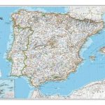
Spain and Portugal in the Reign of Charles III Wall Map
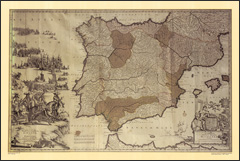
The Iberian Peninsula on a reproduction of a map published by the Dutch cartographic and engraving firm of Danckerts showing the theatres of regional conflicts during the rule of Charles III who reigned from 1759 to 1788.The map, to give its full title ‘Accuratissima Totius Regni Hispaniae, Tabula per Iustinium Dancherts ‘“ Theatre de la Guerre en Espagne et en Portugal Presente a Charles III, Roy d’Espagne et des Indes, etc, etc”, is surrounded by beautiful engravings, including flotillas of ships, soldiers, etc. The map, reproduced by Spain’s civilian survey organization IGN/CNIG is printed on high quality glossy paper.

Related Products:
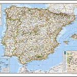 Spain and Portugal NGS Classic Wall Map PAPER
 Spain and Portugal NGS Classic Wall Map ENCAPSULATED
 Spain and Portugal NGS Executive Wall Map ENCAPSULATED
 Spain & Portugal ITMB
 Spain and Portugal De Long Wine Wall Map
 A Guide to Wild Spain, Portugal and Gibraltar
 Spain – Portugal F&B
 Spain and Portugal Philip`s Road Map
 Spain – Portugal Marco Polo Road Atlas
 Spain & Portugal De Long Wine Map
 Spain & Portugal F&B
 Lonely Planet Spain and Portugal`s Best Trips
 Portugal & South of Spain ITMB
 Spain and Portugal 1842 SMALL
 Spain and Portugal 1885 SMALL
 Spain – Portugal Hallwag Road Map
 Touring Spain and Portugal: 2020
 Spain & Portugal Michelin Mini-Atlas
 Spain – Portugal Adventure Map
 NP67 West Coasts of Spain and Portugal Pilot 2021
 Atlantic Spain and Portugal Pilot
 Spain & Portugal Insight Travel Map
 Spain & Portugal AA Road Map
 Spain & Portugal Michelin 2022 Tourist & Motoring Atlas
 SHOM Charts for Spain – Portugal – The Strait of Gibraltar – The Alboran Sea
 Spain – Portugal 2020 Michelin WATERPROOF
 Spain – Portugal MICHELIN Red Guide 2021
 Spain – Portugal 2022 Michelin 734
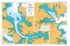
Admiralty Chart Folio 18 – West Coast of Spain, Portugal, Strait of Gibraltar
Spain – Portugal 2022 Michelin 734
Admiralty Chart Folio 18 – West Coast of Spain, Portugal, Strait of Gibraltar
 Spain and Portugal Philip`s 2019 Road Map
 Spain – Portugal K+F Road Map
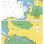
 Admiralty Chart 83 – Ports on the South Coasts of Portugal and Spain
 Spain – Portugal Marco Polo Map
 The Cinema of Spain & Portugal
 Spain – Portugal IGN ESP01
 NP67 West Coasts of Spain and Portugal Pilot – Digital
 Journey to Portugal: A Pursuit of Portugal`s History and Culture
A Walk with Charles Dickens along the Thames
Journey to Portugal: A Pursuit of Portugal`s History and Culture
A Walk with Charles Dickens along the Thames
 The Case of Charles Dexter Ward
 A Birdwatchers` Guide to Portugal: The Azores and Madeira Archipelagos