Disclosure : This site contains affiliate links to products. We may receive a commission for purchases made through these links.
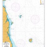
Spain and Portugal 1842 SMALL
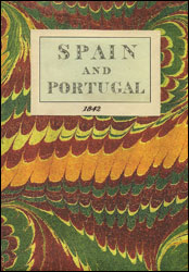
Spain an Portugal in 1842 on a colourful, cloth-backed reproduction (small size) from the Old Folding Maps of a map originally published by G.F. Cruchley as part of their Improved Atlas for Schools and Families. Within Spain regions are presented in different colours; in Portugal the map shows boundaries of the provinces. Hachures indicate mountain ranges and the map shows the names not only of the main rives but also of many smaller ones. Latitude and longitude lines are drawn at 1ยฐ intervals.Each individual cloth-backed map is sold folded in a colourful case covered with a unique design marbled paper ‘“ no two cases are identical.PLEASE NOTE: to see the list of all the titles in this series from the Old Folding Maps please click on the series link.

Related Products:
 Spain and Portugal 1885 SMALL
 France: Cruchley`s Map for Schools and Families c.1842 MEDIUM
 Europe: An Accurate Map of Europe in 1755 MEDIUM
 World: Stanfords Pacific Centred Map of the World 1884 SMALL
 Spain and Portugal NGS Classic Wall Map PAPER
 Palestine or the Holy Land c.1818 MEDIUM
London Bridges SMALL
Palestine or the Holy Land c.1818 MEDIUM
London Bridges SMALL
 The World On Mercators Projection C.1861
 London: Lewis` Topographical Dictionary Plan 1840 MEDIUM
 Oarsman`s and Angler`s Map of the Thames
 Spain & Portugal ITMB
 Switzerland 1890 SMALL
 Portugal & South of Spain ITMB
Palestine or the Holy Land c.1818 SMALL
World Regions c. 1890 MEDIUM
Portugal & South of Spain ITMB
Palestine or the Holy Land c.1818 SMALL
World Regions c. 1890 MEDIUM
 Spain and Portugal NGS Classic Wall Map ENCAPSULATED
London: Rocque London c. 1741-5 MEDIUM
Spain and Portugal NGS Classic Wall Map ENCAPSULATED
London: Rocque London c. 1741-5 MEDIUM
 England and Wales: Brookes` Travelling Companion Map MEDIUM
 Spain and Portugal NGS Executive Wall Map ENCAPSULATED
 Spain – Portugal Adventure Map
 Africa: Gall & Inglis Map c.1854 SMALL
Africa: Gall & Inglis Map c.1854 MEDIUM
Africa: Gall & Inglis Map c.1854 SMALL
Africa: Gall & Inglis Map c.1854 MEDIUM
 Cruchley`s London 1832
 World on Mercator`s Projection by James Wyld c.1861 MEDIUM
 Europe: Cruchley`s New Map of Europe c.1860 SMALL
Paris: Plan de Paris c.1818 SMALL
Paris: Plan de Paris c.1818 MEDIUM
Farther India
India c. 1835 MEDIUM
Europe: Cruchley`s New Map of Europe c.1860 SMALL
Paris: Plan de Paris c.1818 SMALL
Paris: Plan de Paris c.1818 MEDIUM
Farther India
India c. 1835 MEDIUM
 Paris: Plan de Paris et ses Fortifications c.1844 MEDIUM
 Paris: Plan de Paris et ses Fortifications c.1844 SMALL
Farther India MEDIUM
Paris: Plan de Paris et ses Fortifications c.1844 SMALL
Farther India MEDIUM
 Australian Colonies and New Zealand c.1874 SMALL
Australian Colonies and New Zealand c.1874 MEDIUM
Australian Colonies and New Zealand c.1874 SMALL
Australian Colonies and New Zealand c.1874 MEDIUM
 Europe: Stanfords Map of Europe in 1884 SMALL
 Dorset 1801 Map Small
 Bristol: Bartholomew`s Street Plan c.1870 MEDIUM
 Bristol: Bartholomew`s Street Plan c.1870 SMALL
Old Folding Maps Reproductions of Historical Maps
London: Rocque London c. 1741-5 SMALL
Bristol: Bartholomew`s Street Plan c.1870 SMALL
Old Folding Maps Reproductions of Historical Maps
London: Rocque London c. 1741-5 SMALL