Disclosure : This site contains affiliate links to products. We may receive a commission for purchases made through these links.
Southwest USA – American Southwest Borch

Southwest USA in series of laminated, waterproof and tear-resistant, indexed road maps covering the whole country at 1:3,000,000, with additional coverage of California and Florida at a more detailed scale of 1:1,200,000.Each map provides a selection of city centre street plans and maps of selected popular areas. Road detail includes interstates, highways, main roads and secondary roads, with intermediate driving distances indicated on most routes, and high passes indicated. Other information includes main railways, time zones, national parks, national monuments, reserves, Indian reservations, restricted areas and other locations of interest and landmarks. Relief is shown by hill-shading and peak heights. On the 1:3,000,000 maps latitude and longitude lines are drawn at 2ยฐ intervals.Additional larger scale road maps show urban areas or popular regions, e.g. national parks, in greater detail. Clear street plans show one-way streets, landmarks and notable buildings, tram and metro links. All the maps are indexed for towns, locations of interest and streets as appropriate for the scale and level of detail. A multilingual legend includes English.*In this title:* the south-western part of USA extending across to the eastern borders of Colorado and New Mexico and north to include southern Oregon, Idaho and Wyoming. Enlargements provide more detailed road maps of the LA conurbation, the San Francisco Bay area, the environs of San Diego and the Gran Canyon. Street plans cover downtown Los Angeles, central San Francisco, San Diego and Phoenix, plus The Strip area of Las Vegas.

Related Products:
 Northwest USA – Pacific Northwest Borch
 USA: Borch Regional Road Maps
 Southeast USA – The South & Florida Borch
 Northeast USA – New York & Great Lakes Borch
 Ireland Borch
 San Francisco Borch
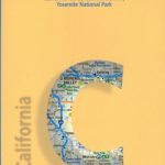 California Borch
 Ecuador Borch
 Chile Borch
 Peru Borch
 Germany Southwest Michelin Regional 545
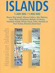 Hawaiian Islands Borch
 Montrรฉal Borch
 Argentina Borch
 Miami Borch
 France Southwest Michelin
 Beijing Borch
 Lisbon Borch
 Buenos Aires Borch
 Vancouver Borch
 New York City Borch
 Cuba Borch
 Aruba Borch
 USA: Antenna Audio American Highway Road Atlas – A4, PAPERBACK
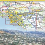 California Southern
 Costa Rica Borch
 Brazil Borch
 India South Borch
 Crete Borch
 Europe Borch
 USA Southwest Reise Know-How
 Senegal & Gambia ITMB
 Tuscany Borch
 Thailand Borch
 Jerusalem Borch
 Sydney Borch
 New Orleans Borch
 India North Borch