Disclosure : This site contains affiliate links to products. We may receive a commission for purchases made through these links.
Southfields 1913 – 123.3
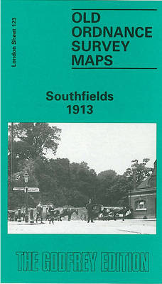
Southfields in 1913 in a fascinating series of reproductions of old Ordnance Survey plans in the Alan Godfrey Editions, ideal for anyone interested in the history of their neighbourhood or family. Two versions cover this area, extending from Putney Heath eastward to Merton Road, and from Wincanton Road and Brathway Road southward to Ryfold Road and St Luke`s church. Development of the `Wimbledon Park` Estate followed the sale of the land by the 4th Earl Spencer to John Augustus Beaumont in 1846. The two maps are quite different:By the 1860s an estate of `stately villas` had been built. These are shown on the 1867 map in their leafy grounds, while further east `South Field` is largely rural, and aspects of Capability Brown`s park can be seen. This is a most attractive map, with a few large houses shown at the top on Putney Heath: Fireproof House, Highlands, Bristol House. At the foot is an area called Parkside. Fine villas line the east side of the Heath – Belmont, Albermarle Lodge, etc – and also on Inner Park Road and Victoria Road. Further east `South Field` is almost entirely rural, while to the south are remnants of Capability Brown`s landscaping, with The Lake. The short directory Wimbledon Park lists the gentry who lived here. The Wimbledon & Fulham railway arrived in 1889 and a much more routine suburb developed around Southfields station. By the time of the 1913 map the term `Wimbledon Park` is shown referring only to the remaining parkland at the foot of the map. East of the railway are many streets of terraces, but the villas of Wimbledon Park still, for the time being, survive.About the Alan Godfrey Editions of the 25″ OS SeriesSelected towns in Great Britain and Ireland are covered by maps showing the extent of urban development in the last decades of the 19th and early 20th century. The plans have been taken from the Ordnance Survey mapping and reprinted at about 15 inches to one mile (1:4,340). On the reverse most maps have historical notes and many also include extracts from contemporary directories. Most maps cover about one mile (1.6kms) north/south, one and a half miles (2.4kms) across; adjoining sheets can be combined to provide wider coverage.FOR MORE INFORMATION AND A COMPLETE LIST OF ALL AVAILABLE TITLES PLEASE CLICK ON THE SERIES LINK.

Related Products:
 Southfields & Wimbledon Park 1867 – 123.2
 Putney 1913 – 113.3
Brixton & Herne Hill 1913 – 116.3
Putney 1913 – 113.3
Brixton & Herne Hill 1913 – 116.3
 Clapham Park & Balham 1913 – 125.3
 East Acton & Wormholt 1913 – 58.3
 Handsworth 1913
Tooting 1913 – 134.3
Handsworth 1913
Tooting 1913 – 134.3
 Birmingham South 1913
 Kew, Gunnersbury & Old Brentford 1913
 Highgate 1913 – 19.3
Walthamstow Marshes 1913 – 22.3
Byker and Heaton 1913
Elswick 1913
Highgate 1913 – 19.3
Walthamstow Marshes 1913 – 22.3
Byker and Heaton 1913
Elswick 1913
 Battersea & Clapham 1913 – 101.3
 Secret Wimbledon & Southfields
 Farnham 1913
Hackney 1913 – 41.3
Farnham 1913
Hackney 1913 – 41.3
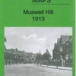 Muswell Hill 1913 – 11.3
Bangor 1913 – 6.12
Muswell Hill 1913 – 11.3
Bangor 1913 – 6.12
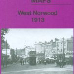 West Norwood 1913 – 136.3
Nottingham North 1913
Camberwell & Stockwell 1913 – 102.3
Halesowen (East) 1913 – 5.13b
Kentish Town & Camden 1913 – 38.3
West Norwood 1913 – 136.3
Nottingham North 1913
Camberwell & Stockwell 1913 – 102.3
Halesowen (East) 1913 – 5.13b
Kentish Town & Camden 1913 – 38.3
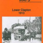 Lower Clapton 1913 – 31.3
 South Acton & Gunnersbury Park 1913 – 71.3
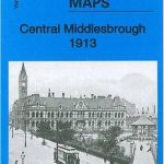 Central Middlesbrough 1913 – 6.14b
Tynemouth 1913
Central Middlesbrough 1913 – 6.14b
Tynemouth 1913
 Whitechapel, Spitalfields & The Bank 1913 – 63.3
 Ealing 1913
Chelsea 1913 – 87.3
East Jarrow 1913
The Hawthorns 1913
Ealing 1913
Chelsea 1913 – 87.3
East Jarrow 1913
The Hawthorns 1913
 Walsall (NE) 1913 – 63.07
 Dulwich Village 1913
 Putney Bridge & Fulham 1913 – 99.3
 Capability Brown: Designing English Landscapes and Gardens
Leicester (NE) 1913 – 31.11
Capability Brown: Designing English Landscapes and Gardens
Leicester (NE) 1913 – 31.11
 Keighley North 1913
Wylde Green 1913
Keighley North 1913
Wylde Green 1913