Disclosure : This site contains affiliate links to products. We may receive a commission for purchases made through these links.
Southern Wind River Range: Elkhart Pass to Big Sandy, WY
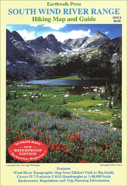
Southern Wind River Range: Elkhart Pass to Big Sandy in Wyoming at 1:48,000 a series of detailed, contoured maps from Earthwalk Press with cartography based on the USGS topographic survey of the country plus additional information for visitors, printed on light, waterproof and tear-resistant synthetic paper. Maps in this series have contours usually at 40 feet and all heights are also given in feet. Colouring shows forested areas, plus, where necessary, additional graphics indicate other important topographic features such as marshland/swamps, moraine, etc. Hiking trails are highlighted, showing where appropriate their trail numbers and/or names. Icons highlight locations of trailheads, campgrounds, picnic areas, ranger stations, plus where available other recreational facilities. Local road network indicates light duty and unimproved dirt roads. GPS coordinates are given as margin ticks.Each title includes comprehensive additional text with useful information, including weather and water warning, regulations, etc, usually prepared by local summer rangers with good knowledge of the area.

Related Products:
 North Wind River Range
 Logan – Bear River Range UT/ID
 Sawtooth Wilderness, ID
 Poudre River – Cameron Pass CO
 Lassen Volcanic National Park, CA
 Whiskeytown – Shasta – Trinity National Recreational Area CA
Anza-Borrego Desert Region, CA
USA: Earthwalk Press Hiking Maps
Great Smoky Mountains National Park, NC/TN
Whiskeytown – Shasta – Trinity National Recreational Area CA
Anza-Borrego Desert Region, CA
USA: Earthwalk Press Hiking Maps
Great Smoky Mountains National Park, NC/TN
 Bozeman – Big Sky – Bridger Range MT
 Deckers – Rampart Range CO
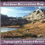 Wind River Range Outdoor Recreation Map
 Ogden – Monte Cristo Range UT NGS Trails Illustrated Map 700
 New River Gorge National River WV
 Rand – Stillwater Pass CO
 Clark – Buffalo Pass CO
 Aspen – Independence Pass CO
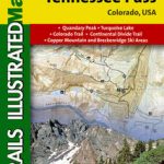 Breckenridge – Tennessee Pass CO
 Green Mountain Reservoir – Ute Pass CO
 Kebler Pass – Paonia Reservoir CO
 Wind River Range South Outdoor Recreation Map
 Crested Butte – Pearl Pass CO
 Idaho Springs – Loveland Pass CO
 Yampa – Gore Pass CO NGS Trails Illustrated Map 119
 White Mountains National Forest East – Presidential Range – Gorham NH/ME 741
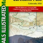 Black Mesa – Curecanti Pass CO NGS Trails Illustrated Map 134
 Steamboat Springs – Rabbit Ears Pass CO
 Tahoe National Forest – Sierra Buttes / Donner Pass CA
 Warsaw Southern Environs
 Winter Park – Central City – Rollins Pass CO NGS Trails Illustrated Map 103
 New River Blueway NC/VA/WV
 South West Corner – Margaret River & Southern Forest Hema
 Buffalo National River West AR
 Buffalo National River East AR
 Columbia River Gorge OR/WA
 Southern Gรถtaland Norstedts Regional Map 1
 Wind River Range North Outdoor Recreation Map
 Salt River Canyon – Tonto National Forest AZ
 Mt Baker – Boulder River Wilderness Areas – Mt Baker-Snoqualmie National Forest WA
 Klaipeda, Kuronian Spit and the Southern Coast