Disclosure : This site contains affiliate links to products. We may receive a commission for purchases made through these links.
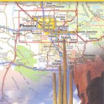
Southern Rockies – Arizona – Colorado – New Mexico – Utah Michelin Zoom 175

Southern Rockies: Arizona – Colorado – New Mexico – Utah Zoom Map from Michelin at 1:1,267,200 (1″ to 20 miles), with highlighting of All-American Roads and National Byways, Michelin’s selections of best sights and scenic routes, plus city maps of Denver, Colorado Springs, Tucson, Phoenix, Albuquerque, and Salt Lake City. Coverage extends from the northern borders of Utah and Colorado to the Mexican border and from Las Vegas eastward to Amarillo in Texas.Each map in the Michelin Zoom series of USA covers a large area, presenting its topography by unobtrusive background shading with plenty of names of mountain ranges, valley, deserts, etc. Peak heights are given in feet. Colouring highlights national/state forests and other protected areas, Indian lands, and restricted entry military zones. Road network clearly distinguishes between free and toll routes and indicates toll barriers, interchange numbers, services, rest areas and Travel Centers. Road numbers are clearly marked on all types of roads and driving distances, in miles, are shown on interstate, main state and selected provincial routes. The maps show state borders and the time zone boundaries. Symbols indicate campsites, sights recommended in Michelin’s Green Guides and other places of interest. The maps have latitude and longitude lines at 1ยบ intervals. The index, arranged by state, is next to the map and also provided is a separate list of sights from the Green Guides annotated with their star ratings.Each map also contains street plans of main cities highlighting places of interest, a month-by-month list of events and celebrations, contact details for national parks, plus a distance table in both miles and kilometres.

Related Products:
 Texas – Oklahoma Michelin Zoom 176
 USA: Michelin Zoom Maps
 Great Lakes Michelin Zoom 173
Deep South – Mississippi to Florida Michelin Zoom 177
Great Lakes Michelin Zoom 173
Deep South – Mississippi to Florida Michelin Zoom 177
 Pacific Northwest – Washington – Oregon Michelin Zoom 171
 Utah & Colorado ITMB
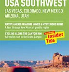 USA Southwest – Las Vegas, Colorado, New Mexico, Arizona, Utah – Marco Polo Guide
 Chateaux of the Loire Michelin Zoom 116
 Bordeaux and surrounding Area Michelin Zoom 126
 Toulouse and Surrounding Area Michelin Zoom 129
 Perigord – Quercy Michelin Zoom 118
 Black Forest – Alsace – Rhine Valley Michelin Zoom 131
 USA: Michelin Regional Road Maps
 Environs of Paris Michelin Zoom 106
 Basque Coast – South Landes Michelin Zoom 133
 Spain: Michelin Zoom Espaรฑa Road Maps
 Southwest – Southern Rockies USA 06 Hallwag Road Map
 Northeastern USA – Eastern Canada Michelin Regional 583
 Southeastern USA Michelin Regional 584
 Colorado Easy-to-Read Rand McNally
 Western USA – South Western Canada Michelin Regional 585
 Colorado Easy to Fold Rand McNally
 Colorado Plateau – Canyonlands – Southern Rocky Mountains
 Colorado Recreational Map
 Massif Central Michelin Zoom 130
 Colorado Springs CO Rand McNally
 Nantes and Surrounding Area Michelin Zoom 128
 Costa del Sol Michelin Zoom 124
 Arizona
 Coast of Galicia Michelin Zoom 141
 New England – Hudson Valley Michelin Regional 581
 Costa Dorada Michelin Zoom 148
 Pyrenees East – Catalan Pyrenees – Andorra Michelin Zoom 146
 France Michelin Booklet Atlas
 Southern France Michelin
 Asturias – Costa Verde Michelin Zoom 142
 Hiking the Southwest – Nevada, Arizona, Utah and New Mexico
 French Riviera – Massif de l`Esterel Michelin Zoom 115
 Canary Islands Michelin Zoom 125
 Cantabria Coast Michelin Zoom 143