Disclosure : This site contains affiliate links to products. We may receive a commission for purchases made through these links.
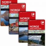
Southern Norway North – Oslo – Bergen – Rondvassbu – Galdhopiggen Cappelen Sectional Road Map

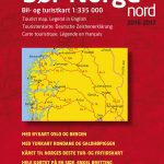
Southern Norway North: Oslo – Bergen – Sognefjord – ร…lesund region at 1:335,000 from Cappelen, covering several national parks including Jotunheimen and Rondane (both also shown on contoured enlargements), plus city maps of central Oslo and the Bergen area.Coverage extends from Oslo and the Hardangervidda NP northwards to ร…lesund and Rรธros and also includes the Jostedalsbreen, Breheimen, Reinheimen, Dovrefjell – Sundalsfjella and Fefundsmarka National Parks. Additional panels provide contoured mapping at 1:100,000 of the Jotunheimen and Rondane National Parks showing main trekking routes with timings, plus city maps of Oslo (25K) and Bergen (20K) highlighting principal traffic arteries, naming neighbourhoods and main streets, and showing locations of various facilities and places of interest. Road maps in the Cappelen’s regional series present topography by relief shading with numerous spot heights and names of various mountain ranges, peaks, valley, etc, plus colouring for woodlands and national parks. Road network, graded into seven types, includes selected cart tracks and indicates tolls, seasonal closures, roads closed to the public, steep gradients, etc. Driving distances are marked on main and on selected secondary roads. Also shown are selected footpaths, with some waymarked DNT (Norwegian Trekking Association) routes annotated with approximate walking times. Railways lines are shown with stations and ferry connections are marked. The maps are particularly good at highlighting accommodation facilities, with an extensive range of symbols showing hotels, motels, campsites, youth hostels, etc, indicating different standards and categories. Other symbols show places of interest, viewpoints, bird colonies, etc. Latitude and longitude lines are drawn at 15’ and 30’ respectively. There is no index of place names. Map legend includes English. The maps now also provide street plans main cities and/or detailed enlargements of popular hiking areas – for more details please see the individual descriptions.To see other titles in this series please click on the series link.

Related Products:
 Southern Norway South – Oslo – Stavanger – Bergen – Hardangervidda Cappelen Sectional Road Map
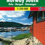
 Southern Norway South: Oslo – Stavanger – Bergen – Hardangervidda NP
 Lofoten – Vesteralen Islands – Senja Cappelen Sectional Road Map
 Norway: Cappelen Regional Road Maps
 More and Troodelag – Alesund – Trondheim – Namsos Cappelen Sectional Road Map
 Troms and Finnmark – Tromso – Hammerfest – Kirkenes Cappelen Sectional Road Map
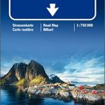
 Oslo / Bergen & South of Norway ITMB
 Nordland and South Troms – Bronnoysund – Bodo – Narvik Cappelen Sectional Road Map
Oslo Cappelen Street Atlas
Nordland and South Troms – Bronnoysund – Bodo – Narvik Cappelen Sectional Road Map
Oslo Cappelen Street Atlas
 Norway South – Oslo – Stavanger – Bergen K+F Regional Road Map
 Norway South – Oslo – Bergen – Stavanger F&B
 Norway Central – Oslo – Bergen – Alesund K+F Regional Map
 South Norway South: Oslo – Stavanger – Bergen – Hardangervidda
 Bergen Cappelen Street Plan
 Greater Oslo Cappelen Street Plan
Norway Cappelen Motorcycle Map-Set
Greater Oslo Cappelen Street Plan
Norway Cappelen Motorcycle Map-Set
 Southern Norway North: Sognefjorden – Jotunheimen NP – Rondane NP – Trondheim
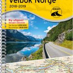
 Norway Cappelens Road Atlas A4 SPIRAL-BOUND
 Norway South Reise Know-How
 Norway F&B Supertouring Road Atlas SPIRAL-BOUND
 Central and North Norway: Bodรธ – Lofoten
 North Norway: Narvik – Tromsรธ ‘“ Hammerfest – Vadsรธ
Southern Sweden and Norway Reise Know-How
North Norway: Narvik – Tromsรธ ‘“ Hammerfest – Vadsรธ
Southern Sweden and Norway Reise Know-How
 Norway – Oslo to North Cape & Svalbard
 USA – Southern Canada Marco Polo Road Atlas A4 SPIRAL-BOUND
 Norway: Norstedts Regional Road Maps
 Norway Road Atlas SPIRAL-BOUND
 Southern Sweden and Norway Adventure Map
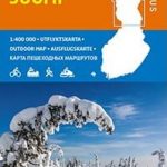 Finland North Karttakeskus Outdoor Road Map
 Norway K+F Road Map
 Norway F&B
 Italy North K+F Road Map
 Oslo, Norway
 Southern Italy – Sardinia – Sicily TCI 400K Road and Tourist Map
 Finland North Karttakeskus Road Map
 Oslo Nordmark SUMMER edition Nordeca 2423
 Finland Road Atlas GLOVEBOX, SPIRAL-BOUND
 Oslo Nordmark WINTER edition Nordeca 2425
 Oslo รstmark Nordeca 2283