Disclosure : This site contains affiliate links to products. We may receive a commission for purchases made through these links.
Southeast Asia Nelles
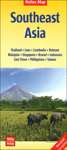
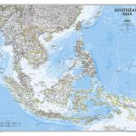
South-East Asia with Indonesia, Philippines and Taiwan presented at 1:4,500,000 on a double-sided, waterproof and tear-resistant map from Nelles, with its smaller size offering a convenient format for use when travelling. The map divides the region north/south with a generous overlap between the sides. Coverage includes central and southern Burma; Taiwan and Indonesian Papua are shown on insets. Within Indonesia and Philippines numerous small islands are named.Topography is presented by light altitude colouring and spot heights, with names of mountain ranges, peaks, etc. The map shows the regions main and selected secondary roads, railway lines and local airports. Ferry routes are not included. Symbols indicate various places of interest. Latitude and longitude are shown by margin ticks at 4ยบ intervals. The map is not indexed. Map legend includes English.


