Disclosure : This site contains affiliate links to products. We may receive a commission for purchases made through these links.
Southampton – Eastleigh – Fawley – Hythe – Romsey A-Z Street Atlas
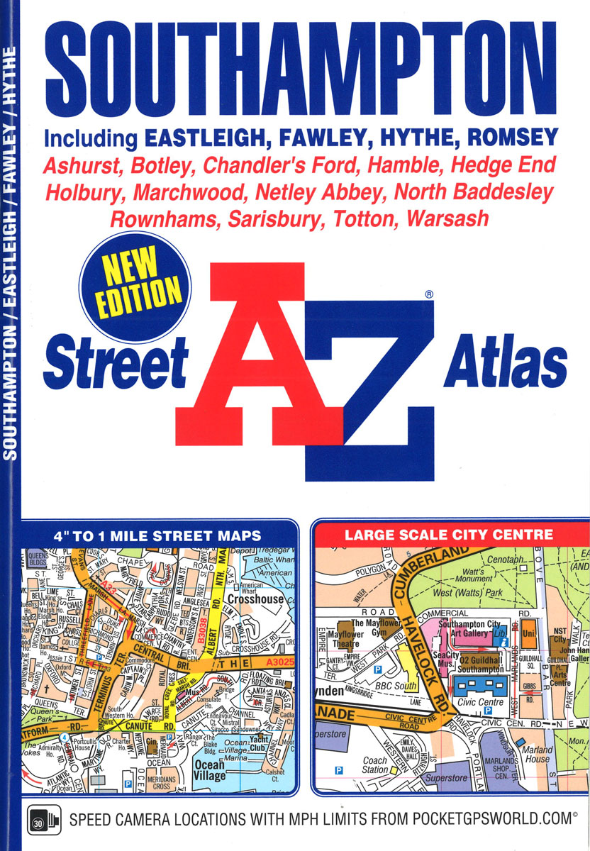
This A-Z map of Southampton features 50 pages of street mapping extending to include:Eastleigh, Fawley, Hythe, Romsey, Southampton Airport, Totton, Chandler`s Ford, Hamble-le-Rice, Hedge End, North Baddesley, Swaythling, West EndA large scale city centre map of Southampton is also included.Postcode districts, one-way streets, safety cameras with speed limits and National Park boundaries are featured on the mapping.The index section lists streets; selected flats, walkways and places of interest; place, area and station names; hospitals and hospices covered by this atlas.

Related Products:
 Southampton A-Z Street Atlas
 Liverpool A-Z Street Atlas
 Manchester A-Z Street Atlas
 Bournemouth A-Z Street Atlas
 Greater Manchester A-Z Street Atlas
 Coventry – Rugby A-Z Street Atlas
 Norwich A-Z Street Atlas
 Nottingham – Ilkeston – Long Eaton – West Bridgford A-Z Street Atlas
 Newcastle upon Tyne A-Z Street Atlas
 Merseyside A-Z Street Atlas
 Birmingham A-Z Street Atlas
 Southampton A-Z Pocket Street Map
 Canterbury – Margate – Ramsgate A-Z Street Atlas
 Southampton – Portsmouth A-Z Street Atlas
 Portsmouth A-Z Street Atlas
 Ipswich – Felixstowe A-Z Street Atlas
 Cardiff A-Z Street Atlas
 Taunton A-Z Street Atlas
 Brighton and Worthing A-Z Street Atlas
 Nottingham A-Z Street Atlas
 Edinburgh A-Z Street Atlas
 Cambridge A-Z Handy Map
 London A-Z Street Atlas
 Greater London A-Z Master Atlas
 London A-Z Big Street Atlas
 Bath A-Z Handy Map
 Aberdeen A-Z Street Atlas
 Isle of Wight A-Z Street Atlas
 Dartford – Gravesend A-Z Street Atlas
 Weymouth – Dorchester A-Z Street Atlas
 Hastings – Bexhill – St. Leonards – Rye A-Z Street Atlas
 Bolton – Bury A-Z Street Atlas
Southport – Formby – Ormskirk – Skelmersdale A-Z Street Atlas
Bolton – Bury A-Z Street Atlas
Southport – Formby – Ormskirk – Skelmersdale A-Z Street Atlas
 Southend-on-Sea – Basildon – Billericay A-Z Street Atlas
 Macclesfield – Congleton – Knutsford – Wilmslow A-Z Street Atlas
 Nottinghamshire A-Z County Street Atlas
 Basingstoke- Andover – Overton – Whitchurch A-Z Street Atlas
 Loughborough – Melton Mowbray A-Z Street Atlas
 Crawley – East Grinstead – Horley – Horsham A-Z Street Atlas
 Southampton A-Z Street Plan Wall Map